My hiking partners and I had tried to do this hike back in the winter, but had arrived at the trailhead to find the footlog which crosses the river washed away. Later, we read that there were no plans to rebuild, so we decided at the time to attempt this hike in the summer when the fairly long crossing wouldn't leave us cold and wet at the very beginning of the hike. However, as we pulled up to the trailhead on this day, there was a brand-spanking new footlog stretched across the river. This is reportedly the longest footlog bridge in the Park. Thrilled that the only marked crossing on this trail had been spanned for us by this awesome bridge, we chose to leave our water shoes in the car--a mistake, for sure!
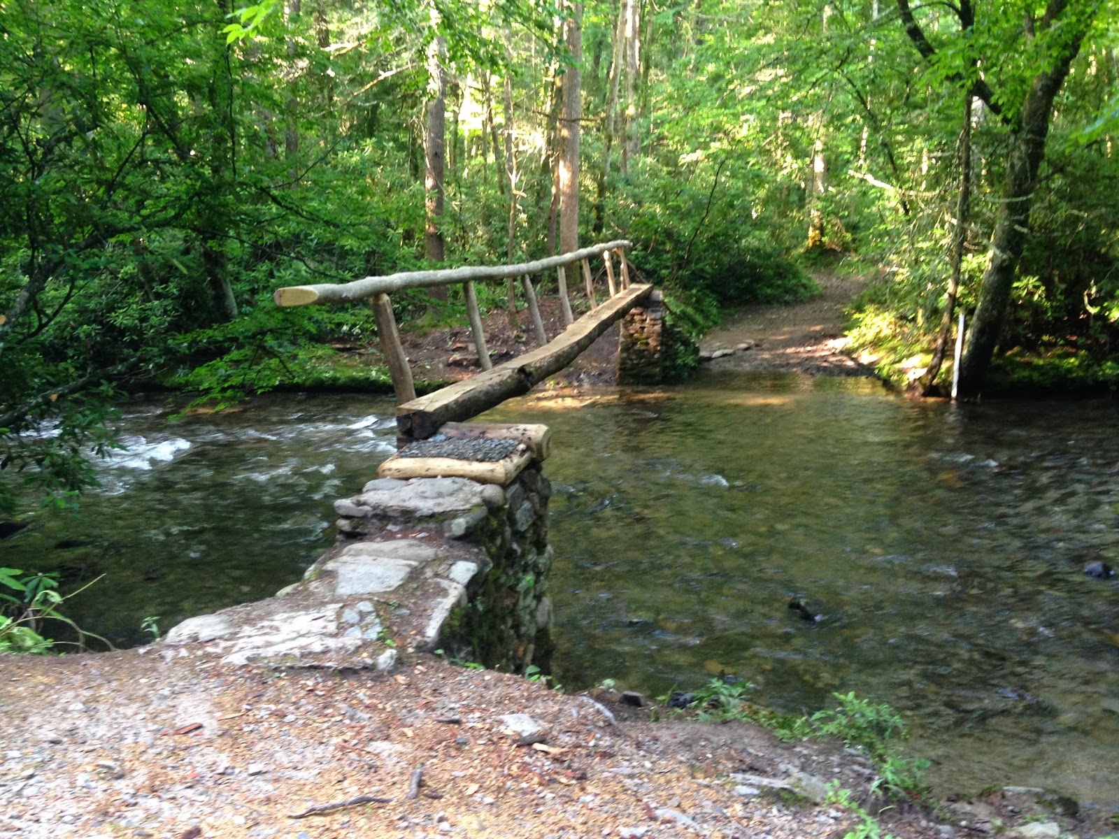 |
| The brand new bridge replaced only a couple days before we got here |
Within the first mile, though, we came to a deep water crossing with no bridge. We were close enough to the car I could have gone back for shoes, but didn't want to add almost two miles to our hike because I really want my husband, Bunk, to keep hiking with me. I choose my trails with him carefully to keep it fun and enjoyable for him. That's very important to me. So our only choices were to take the boots off and enter the water, unable to see what lay on the riverbed, or just push on through with our boots on. We chose the later knowing that would mean wet feet for the rest of the day.
 |
| One of many unbridged crossing on this hike |
Almost immediately, we came to the first intersection with Boogerman Trail and turned left to begin the fairly gentle ascent up to the ridge. Caldwell Fork Trail, being a horse trail, was fairly well travelled it seemed, but not so with Boogerman Trail. There was some slight overgrowth along the way, but it's still pretty early summer. I'd say by the end of July there'll be some significant overgrowth. But it was an enjoyable trail nonetheless. It did not contain the muck and mire typical of horse trails like Caldwell Fork, and the pine needles and deciduous leaves that had fallen on the trail made it fairly soft underfoot. Only minimal rocks and roots were present, so tripping wasn't such a distinct possibility. I spent my time watching for snakes, but thankfully, none made an appearance!


There are some interesting sites along Boogerman Trail too. At one point we passed what looked to be a very old tulip poplar (I could be wrong on the identification though. Tree ID is not my thing.) Not long after that we came to a VERY long rock wall built by early settlers of this region. There was no mortar used in this wall, but I bet it had been here since the 1920s or 30s, if not before, and still stood tall and proud. It's hard to imagine the amount of work it took to build that structure, and I tried not to think of what it must have been like to be forced to leave an area that had been your home as these settlers had been. As I hike these trails, I am often reminded of their sacrifice so that I can enjoy the park that was set aside for the use of all Americans on land that had once been their own homeplace. I experience a dichotomy of feelings, that's for sure.
 One of the most interesting sites along this trail was a huge tree that is hollowed out at the base, presumably by lightning. This tree still lives, but with a hollowed-out crevice in it large enough for people to stand in. I didn't go in (I don't like spiders or snakes), but you could tell others had. This, to me, is just another example of the tenacity of nature, the doing whatever it takes to survive. Adapting to unforeseen and unfortunate circumstances seems to be the norm in nature, something that comes in handy for us as humans too, it seems. Shortly after seeing the tree and the rock wall, we came to the end of Boogerman Trail and the intersection with Caldewell Fork. Here, we took a few minutes respite to eat a snack and rest our feet. I was in the middle of changing into dry socks when we heard a huge crash in the woods. I called out, hoping it was someone coming down the trail from the other direction, but got no response. I thought it was probably a bear, but we tried to convince ourselves it was a limb falling from a tree. We packed up pretty quickly at that point and headed up the short piece of Caldwell Fork to the next trail intersection. I needed to do that little piece to make the next jaunt in that area a little easier. After doing that short piece up and back, we returned to the intersection where we'd had our lunch. Walking now back toward our vehicle on Caldwell Fork, we again encountered the muddy stretches commonly found on horse trails. However, now there were large prints freshly made in that mud. My first comment to Bunk was I hoped that was just someone's large dog. Although dogs are not allowed on trails in the Smokies, it is not unusual to run into people who ignore that rule and hike with their dogs anyway. I was hoping that's what it was, but deep inside, I figured it might not be. Soon we came upon two sets of tracks, one the large ones we'd previously seen and one much smaller. This time, the claw marks on the toes were clearly visible, leaving us with no doubt that this was a large female black bear and her this year's cub alongside her.
It does seem that the bear population in the Smokies is particularly unpredictable this year, especially in the last few weeks. There are multiple closures of trails and shelters in the Park because of aggressive bear activity. You can find that list HERE. If you're heading into the park anytime this summer, be sure to check that site. It begins with road closures, but scroll down a bit to find facilities closed or on alert due to aggressive bear activity. I read an article in a Sevier County online magazine the other day that said now is the time for mating of the black bears, so males will stand their ground to protect their territory even from people. Usually, they will run away at the sight or sound of hikers, but not during this time. Also, right now is the time when momma bears are weaning their yearling cubs, so it's not unusual to see those half-grown cubs in the woods alone, looking somewhat confused. They, too, can be somewhat unpredictable according to those reports. I highly suggest that if you're headed to the Smokies, you take a few minutes to watch the video on bear safety located on the Park website. You can find it and other information you need to know about being in bear country HERE. There's also a good video HERE put out by Orvis on how to use bear mace correctly. It's worth watching too. What you learn there could save you from an unfortunate encounter, and also might save the life of a bear. Bears who are caught up in encounters with humans, even if those situations are caused by poor behavior of people, often have to be put down. So, please, know the rules and safety regulations that can prevent such unhappy situations from occurring. A photograph just isn't worth it.
 |
| Young bull elk on Cataloochee Campground Road |
The rest of our hike was uneventful, but as we were driving back up the road out of the campground, we were pleasantly surprised by the presence of a young bull elk grazing just on the side of the road. He was adorned with huge antlers which were "in velvet." When antlers are being regrown each year (elk and deer lose their antlers after the "rut" or breeding season), they are covered with a soft, velvety covering that is accompanied by rich blood flow to the growing cells. Once the antlers are fully developed, that velvety covering will be rubbed off and the antlers become hard. Anyway, he was beautiful! We did not get out of the car because we were too close, but snapped a few pictures as we moved on up the road.
What a day this had been! I absolutely love sharing days in the woods like this with my husband. It seems the cares of our normal daily lives just vanish in the splendor of what has become my favorite place on the planet. I am so blessed to live close to the Great Smoky Mountains National Park and to have a husband who will hike in it with me!


