Tuesday, January 26, 2016

A Beginner's Guide to Hiking in the Great Smoky Mountains National Park

The Centennial Celebration's "Find Your Park" logo, encourages everyone to get involved in National or State Parks.

I was talking today with a long time volunteer with the Smokies who is helping organize the National Parks Centennial Celebration at our local level. We discussed what I had heard for many years, that a staggeringly high percentage of visitors never venture far from their vehicles while visiting this special place. Some never leave their car and see the Park only through their windshields. How sad!

In this year of the Centennial Celebration, a focus of the efforts and vision of Superintendent Cassius Cash is to reach out to the younger generations, the millennials and younger, as well as diverse populations to encourage them to experience the Park on a personal level. It is these individuals who will carry the torch into the future and help make sure the National and State Parks' futures are secure. It is vital that they become involved at a higher level than they currently are or the passion that protects these amazing places may dwindle. Those of us who love Great Smoky Mountains National Park (or any other park for that matter) need to carry the banner and begin the process of handing it off to the younger generations. I can think of no better way than to get folks out of their cars and onto the trails where they can experience the magic for themselves.

Honestly, to some visitors and even some local folks, hiking in the Smokies can be an intimidating prospect, but it certainly doesn't have to be. Three-fourths of the year, during tourist season, a newbie can find a wide, well-travelled trail and thrill to the gurgle of a creek, the roar of a waterfall, or the silence of the forest--an experience that will undoubtedly soothe even the most savage beast of our modern, stress-laden world--with a minimal amount of preparation.

So, for our visitors who might otherwise stay in their cars and never truly "see" the Park, let me make some recommendations on gear and also on some trails you will LOVE, some of which you may not hear of otherwise.

GEAR for a First Hike in the Smokies    

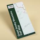
The single most important piece of equipment you need to have with you will cost you a whopping $1.00--a MAP. These dollar maps can be purchased at any Visitor Center and at some other locations in dispensers where you simply put a dollar in and get out a map. It can be ordered before your trip HERE. It's absolutely essential that you purchase one! It will make a great souvenir anyway and might keep you from becoming disoriented in the woods.

Shoes or boots--You do not have to have hiking boots or hiking shoes to do the trails I am listing here in this post. Some of them could possibly be enjoyed in less for short distances, but do yourself a favor and use tennis shoes or better. Enjoying the trail will be easier if your feet are protected by a solid shoe. Just remember, the Smokies are a temperate rainforest, so there will often be muddy sections on most any trail. Flip flops (or dare I say it because I've seen it--high heels) can be downright dangerous on a muddy, rocky, or root-strewn trail.

Water--Always carry water with you when you venture out for a hike. If you're planning on hiking more than a mile or two, especially in hot weather, carry at least a quart of water with you. It is not recommended that you drink the water in the streams and rivers, tempting as that might be, so be sure to carry some with you.

Food--It's always a good idea to have a little bit of food with you on any hike, even a short one like we are going to talk about in a minute. Stick a protein bar or a bag of nuts in your pocket to help fuel your body as you walk in our woods. The further you plan to hike, the more food you'll want to pack. Just please remember to pack the wrapper or any other trash back out with you to protect our wildlife and the experience of others who do not want to see trails littered with orange peels or food packaging. Food scraps left in the woods KILL our bears, so if you pack it in, please, pack it out!

Camera--I wouldn't send you into the Smokies without a way to capture the treasures you will find along its trails. You have no idea what awaits you! You WILL want to remember it, and since you cannot remove anything (no rocks, plants, leaves, sticks, nothing!), a camera provides you with a record of the special sights you will enjoy. Remember, "Take nothing but pictures, leave nothing but footprints."

A Careful Eye on the Sun or your Watch--As a novice hiker, you do not want to be caught in the woods at nightfall, so please allow yourself plenty of time to enjoy your hike, yet complete it before the sun gets too low in the sky. These deep woods get dark more quickly than you might think (and when they get dark the temperatures drop surprisingly quickly), so unless you've packed flashlights or headlamps for everyone in your party, start early in the day. Allot yourself about one hour for each mile you will hike. This should allow ample time for taking in the sights, snapping lots of pictures, stopping to rest and snack, and still get you back to your car before sunset.

Realistically, for a short hike of only a few miles on the trails I list here, these are the essentials. Other items are a good idea: compass (if you know how to use one), a whistle, rain gear (vital if the weather is cool in fall or spring; potentially life-saving in winter) and a light backpack to contain it all. If after sampling some of these trails, you become hooked on hiking as many have, you will want to invest in more gear before venturing off the well-travelled trails or for longer hikes. But this will get you started. Take the time to get off the pavement and onto the trails below. You may never be the same!

FAVORITE TRAILS for Beginners

The trails I list here are a delight for the beginning hiker. There is little to no risk of getting lost if you simply stay on the trail, and they offer sights and sounds uniquely engaging for those who take the time to enjoy a walk in the woods. They are well-travelled which will make even the most novice hiker feel safe knowing that others are not too far away in case anything unexpected does happen.

ON THE TENNESSEE SIDE:

Little River Trail--near Elkmont--This is a wide, almost level trail that was once a road. It follows along Little River amid old vacation homes of the village of Elkmont. These homes, for the most part, are now condemned and should not be entered. It is nice to observe these old homes and think about what it must have been like to stay here. Some were occupied as late as 1992 due to leases that were negotiated before the Park took ownership of the land. To me, though, the biggest draw for this trail is the river itself. Numerous small cascades are worth stopping to see and photograph. There are many places along the trail where you can stop with a picnic lunch and let kids play in the river. I used to do it all the time when my own children were young. There are some huge boulders along the river which make excellent picnic tables. This trail goes on for over 6 miles, but a new hiker will enjoy a stroll up Little River for any distance that is comfortable and then can simply turn around and return to the car.

Meigs Creek Trail--trailhead is located at the Sinks--I recommend doing this trail in the summer because there are 18 water crossings on the entire length (3.5 miles one way) of the trail. I also recommend NOT doing it after heavy rains as the crossings may become dangerous. But on a warm summer day when rains have been minimal, in shoes you don't mind getting wet, this trail is a real joy! Most of the crossings occur after the first mile, but this section of forest is just lovely. I have seen bear, turkey, ruffed grouse and even a black racer snake along this trail. Upper Meigs Falls can be seen from the trail at about 1.75 miles and this is a good place for the novice hiker to turn around, after enjoying the falls, making your total hiking distance about 3.5 miles.

Middle Prong Trail--in Tremont--Another wide path which follows a river on a trail which once was a railroad bed. This trail has a little more elevation change than Little River, but also has a dramatic waterfall a little less than 3/4 of a mile out. There is a bench located at the falls for resting and reveling in the sights, sounds, and smells of the Park. You can hike further up Middle Prong if you wish, again turning around whenever you need to and simply return to your vehicle. Something you are sure to find on any of these in and out hikes is this: even though you've just walked up the trail, when you turn around and go back, it's like you're on a different trail. You will see things you didn't notice on your way up; perspective changes and so will the scenery.

CCC Camp Clock Tower and the men who worked there
Old Sugarlands Trail--right across from Sugarlands Visitor Center--This is a HISTORY hike! This delightful trail takes you through the heart of a once vibrant community of hard-working individuals who eeked out their livelihood by farming and raising livestock to support their families. Untold numbers of relics from their homeplaces remain in this area and many can be seen from the trail. Look for stone walls and remnants of chimneys. If you're here in the spring, know that daffodils mark some of the homesites to this day. There are a couple places where other trails (horse trails primarily) intersect with Old Sugarlands but the trail is well-marked. Just be sure to check the signage (and that MAP you're carrying) and make sure you remain on the main trail. One of my favorite historical sites in the Park can be found at about 1.5 miles. Where the trail takes a hard, dog-legged right turn, look up and into the woods. Depending on the season in which you make this trip, you will be able to see (sometimes very easily) the old clock tower that once marked the entrance to a CCC (Civilian Conservation Corp) camp which was the working home to the men who built much of the infrastructure of our Park. There is also a stone circle which surrounded the flag pole and many other pieces of evidence of this earlier time in history. It is definitely worth a few minutes of your time!

Andrews Bald offers spectacular views of the NC side of the Smokies
Forney Ridge to Andrews Bald--off Clingman's Dome Parking Area--Of all the hikes listed here on the Tennessee side of the Smokies, this may have the biggest payoff with incredible views of the surrounding Smoky Mountains from an elevation of approximately 5800 ft. You can see equally inspiring views from the parking lot, but remember, my goal is to get you off the pavement and into the backcountry so you can REALLY experience this national treasure. Your sense of accomplishment after having hiked to these vistas will more than make up for the time you spend. The memories will remain with you always, so get onto Forney Ridge Trail and walk to Andrews Bald. The trail courses through forests and is often lined with wildflowers in the spring or with wild blackberries and wild blueberries in the summer, but at 1.8 miles from the trailhead, you step out onto Andrews Bald. The vistas here will take your breath away! Plan to spend some time or maybe pack a lunch. You will want to tarry, I promise! However, this hike is not as level as the trails mentioned in this post that were once roads or even railroads, so be prepared for some minor climbs. Do be careful at an intersection about one mile into your hike that you stay on Forney Ridge trail. Forney Creek Trail goes off to the right and down away from your destination. Andrews Bald is on Forney Ridge, so stay straight at that intersection.

Porter's Creek--in Greenbrier--If you come to the Park in April or early May, do NOT miss this trail! Porter's Creek is world-renowned among wildflower enthusiasts and offers a delightful array of tiny gems blooming along the path and into the woods. You will be blown away by the variety and delicate intricacies on display in the Spring. But this trail is also a gem other times of the year. Many homesites were located along this trail so you will see stone walls, remnants of chimneys, and a cemetery. The old Smoky Mountain Hiking Club Cabin is located along this trail at approximately a mile. Take some time to explore it. You will not want to leave! Then if you decide to go further, you can hike to Fern Branch Falls at approximately 1.7 miles by continuing to follow Porter's Creek Trail.


Hen Wallow Falls on Gabes Mountain Trail
Gabes Mountain Trail--in Cosby--If you visit the Cosby area, there is one short hike that rates high on my list for beginners--Gabes Mountain Trail, if you feel like you can do about 4.25 miles round trip. This trail is a bit of a climb up to Hen Wallow Falls, but my children have done it as have many others. Many of the hikes in the Cosby area have much more significant elevation gains, so this trail is easier than some of those, again with a big payoff. Hen Wallow Falls is definitely worth the trip. You will see a small sign that sends you off on a short side trail down to the base of the falls at 2.1 miles into your hike. There are large boulders at the bottom that make a perfect spot for a picnic lunch. Just be sure to pack out any trash (even "natural" trash like orange or banana peels). Enjoy!


ON THE NORTH CAROLINA SIDE:

Big Creek Trail--in Big Creek--This trail offers a little something for everyone--wildflowers in the spring, a delightful walk along a gorgeous river complete with numerous cascades, a chance to watch kayakers navigate chutes and eddies, large rock formations that echo the sounds of the river, intensifying the experience, and much more, all along another roadbed hike with little elevation change. There are two major destinations on this hike within the first two miles of trail. A popular swimming hole, Midnight Hole, is at the bottom of a chute of river between two massive boulders located at 1.4 miles from the trailhead. A little further up the trail, at 2.0 miles, Mouse Creek Falls plummets into Big Creek. Many a family photo have been taken from that spot!

Mt. Sterling Fire Tower
Mt. Sterling Trail to the Fire Tower--half way between Big Creek and Cataloochee on dirt road NC Hwy 264--Not only is this trail hard to get to, it is a short but STEEP climb of almost 2000 ft over 2.7 one-way miles. If you are in the physical condition to do it though, this is one of those places in the Park where you can get life-changing vistas, this time at the top of the Mt. Sterling Fire Tower (not for the faint of heart or if you have a fear of heights). For this hike, though, I would recommend a backpack with plenty of water and some extra food. Your body will need the support on this hike. I almost didn't include this hike here, but it is such a breathtaking experience (both literally and figuratively), I thought I would include it with the caveats I have mentioned. If you are unsure about your physical abilities, pick a different hike. This is definitely the most difficult hike in this list.

Bradley Fork--at Smokemont Campground--At the very back of the Smokemont Campground lies one of the most picturesque "easy" hikes in the Park, and most folks never see it. This is a long trail that eventually climbs high up toward the Appalachian Trail, but the beginning section is truly beautiful, and almost flat, as it follows the course of the Bradley Fork of the Oconaluftee River. Perhaps I love this trail so much because the Bradley Fork is also a nice trout stream, but I remember the first time I hiked it, it simply felt magical! I encourage you to meander along as far as you like and then turn around and head back to the campground. You can spend as little or as much time as you have available, and it will all be well spent.


Kephart Prong Shelter
Kephart Prong Trail--off of Newfound Gap Road above Smokemont Campground--An adventure through history awaits you if you take this 4-mile round trip through another old CCC Camp area and out to the Kephart Shelter, named for Horace Kephart, a man instrumental in the creation of this Park. Abundant historical remains can be found on either side of this trail including old chimneys, rock walls, an old fishery, and then of course, this wonderful shelter--another perfect spot for a picnic.


Deep Creek Trail--near Deep Creek Campground--This is a much beloved trail by those who visit the Deep Creek area of the Smokies, and for good reason. Another old roadbed trail, this trek will take you to Tom Branch Falls within the first quarter of a mile. Families love this hike because there are many spots along the trail to launch inner tubes for an easy float down the river back to the campground. I must admit my own personal memories of Deep Creek Trail are blurred by exhaustion because every time I've been on it, we've hiked long, arduous miles down from the Clingman's Dome area to get to it, but I had to include it here because so many folks hold such fond feelings for it. If you are in the Deep Creek area, by all means venture up this fine and easy trail and see for yourself.

Intentional Omissions--There are a few well-known trails that I have intentionally left off my list, primarily because they are the ones everyone knows about. Therefore, they are so highly travelled, I personally do not find them very enjoyable except during winter, and as such, I could not, in good conscience, include them among my favorites. If you don't mind the crowds, then by all means, consider Laurel Falls, Abrams Falls, and Chimney Tops. If crowds are not your thing, hopefully, you have found some other options here.

Since my goal in writing this post is to get you out of your car and into the woods, please feel free to ask questions in the comments below. I'll be happy to either get you an answer or direct you to someone who can. Happy Trails!

If you are someone who has hiked in the Smokies before, what trails would you have included that I left off? I'd love to hear your recommendations as well.


Wednesday, January 20, 2016

Hiking in the Twitterverse

At the trailhead of Jakes Creek
As I wait for a second pot of coffee to brew to warm my hands on this snow day from school, I reflect on what a positive impact Twitter has had on my hiking adventures, especially of late. I had maintained a Twitter account as a teacher for my Microbiology students to tweet in for several years, but had only used it for that purpose. So I joined Twitter personally three years ago, not having any idea how to really use it, but intrigued by the possibilities of what might be. I began by searching for hashtags that had to do with my newly-developing passion, hiking. Following the tweets of folks who were, in my eyes, professional hikers or companies who shared tremendous knowledge about the sport I was beginning to love, led to me learning important things like how to stay safe in emergencies, simple tricks that made hiking easier, the ever-expanding list of gear I could put on my wish list, and how to pack a backpack the right way. This, however, was only the beginning.

Over the last three years, Twitter has introduced me to wonderful people in my area that share my passion for the Great Smoky Mountains National Park and spending time hiking or taking great photographs in it. Online friendships seemed a little odd to me at first and on at least one occasion I made mistakes and accidentally made presumptions I shouldn't have, creating tension in what had been a jovial alliance, but after so many years, you do begin to feel like you've really known these fellow trekkers for a long time. I cannot tell you how many times I've laughed at the silly banter that takes place among hiking friends even if they've never seen one another. Sharing our love of the Park and its secret places...places that the tourists never see, creates a bond of camaraderie of collective passion. I've learned so much about this beautiful park we are so lucky to have in our backyards!

At the Avent Cabin

Over the last few weeks, I've been blessed to meet and hike with two of our little group, loving called #ETHikerTrash, and am so thankful that I've come to know them. The New Years' Day hike I took with @ginastafford is already recorded here. On Martin Luther King Day, we were joined by @shuckydern, wise and experienced hiker whom I am pleased to now call friend! Gina and Shucky led us to the Avent Cabin, one of those treasures of our Park that is, as another virtual friend,
Steve Oliphant says, "hidden in plain sight," and what a day we had! Temps were no more than 17-20 degrees all day and the wind chill was supposed to be about 10 degrees. We were cold, yes, in fact it took me the rest of the day and two hot baths to finally thaw out. But what a delight it was to hike with Shucky and Gina, along with the other members of the Three Hiketeers with whom I normally hike. We laughed, sniffled from the intense cold, warmed our hands in the sun at the Avent Cabin, ran across Huskey Creek if you take Gina's word for it, and stopped numerous times to just admire the incredible views of snow-capped mountains which surrounded us as we completed the Cucumber Gap loop. We were kindred spirits in our love for these mountains. It was special--special indeed!
Trying to thaw out in the car after the hike!

So, if you're on Twitter, I (@HikerTN) want to introduce you to some really amazing people who have a tremendous wealth of knowledge about our mountains and the sport of wandering through them. Some of these are avid hikers who can share personal experiences about the trails, some are companies that I have learned a great deal from over the years, and some are folks who have many Twitter connections and from whom I learn much from their RTs (retweets). I have even followed the Appalachian Trail Thru Hikes of some of these awe-inspiring individuals. Some of the best photographers I know are among these fine folks as well. Although none of them are technically "professional," they certainly are in my book! And two of them are my closest "real life" friends and hiking buddies with whom I pursue the quest of hiking all the trails in the  Smokies. I am pleased to help you make their acquaintance and hope they bless your life as they have mine. In no particular order (and I apologize up front for leaving anyone out--it's inevitable I would think):

@shuckydern
@ginastafford
@jsmiller2763
@kkmosher
@BobCarrPhoto
@sidbeary
@greglong_13
@GSMNP_hiker
@TrailMixed
@GreatSmokyNPS
@gsmitremont
@JohnMDouglass1
@smoky0305
@ThatOutdoorGuy
@bhartmaneducate
@SprinklesHikes
@niphotographer
@dignthegarden
@LeConteLodge
@MtLeConte
@johncarter_net
@Kplass
@GSMNP
@BackpackerMag
@lynndifiore
@davidwherry
@hardwear
@ORGEAR
@JenOutpost
@BlissfulHiking
@Summitoutadvent
@BlueRidgeXP
@LittleRiverTrad
@REI
@JollyontheAT
@LocalYokelWeather
@AppTrials
@netbros
@AT_Conservancy

If you are a Twitter hiker, who are your favorite folks to follow? I'm always looking for more sources of hiking inspiration and information.

Sunday, January 10, 2016

Appalachian Trail from Max Patch to the Smokies

Our day began extremely early as we drove to Standing Bear Hostel to catch our shuttle to put us on trail at Max Patch somewhere around 8:00. It's funny how getting up at 4:something to go hiking is easier than getting up at 6:15 to go to work! We arrived shortly after sunrise to a frozen tundra and frigid temperatures at the base of the bald. I don't know what the exact temperature was, but it had to be in the neighborhood of 15 degrees. Our shuttle driver told us there were two ways we could begin our hike back to Standing Bear Hostel near I-40 at Harmon Den, NC. We could take the easy way and hike around the base of the bald and catch the AT on the edge near the tree-line. Or we could hike virtually straight up that mountain to the middle of the bald. Three guesses (and the first two don't count) which way we went! You got it--straight up!

I'd been wanting to do this hike for many years. I've heard my dad tell stories from his childhood of picking huckleberries with his father at Max Patch. That would have been almost 80 years ago! This was finally going to be MY day on Max Patch!


 The summit of the bald was definitely worth the climb to get there! The ground was frozen solid and any vegetation (grass, small shrubs, or trees) on the way up was covered with frozen fog or dew from the night or early morning. Fog still hung in the surrounding valleys and it was easy to imagine the bald shrouded in fog only maybe an hour before when the rising sun would have burned it off just for us. This was a picture-perfect day on Max Patch!

Breathless from the climb and the magnitude of the mountain ranges that stretched out in all directions before our eyes, we instinctively spread out, taking in the vistas separately, each soaking up the magic in our own individual reveries.  Moments passed, but eventually the winds and bitter cold temps took their toll. We came back together, oriented ourselves by finding the white blazes painted on fenceposts hammered into the bald to mark the footpath that we would follow for over 13 miles on this day, and headed south. Just as we were leaving the bald, my iPhone totally froze up and turned itself off. That's how cold the temperature and wind chill was on that morning! I was afraid my photography for the day had ended early, but after some time deep in my pocket, the phone began to work again, much to my relief.

Once below the tree-line and shielded from the winds by the mountain ridge to our right, we began to warm as we trekked through the trees and rhododendron thickets. The trail crossed over the road that we had taken to the parking lot then turned left back into the woods and began another rise through the still frozen forest.
Photo credit: My hiking partner, Jennifer Miller, caught this one while my phone was still frozen.

The trail was smooth and wide, evidence that this is an oft-travelled but well-maintained section of the AT, and with good reason! Eventually the day began to warm some and the trail took on the brown tones of any winter wandering in the Appalachian Mountains on a day without snow. We progressed through primarily hardwood forests up hills and down to two different gaps.

Jennifer, Wildcat the AT Chaplain, and Kirsten
During this stretch, at one high point on the trail but still within a heavily wooded area, we came across another hiker. At closer look, we discovered that it was an employee of Little River Trading Company where Kirsten is a frequent customer. Burt, aka Wildcat, is an Appalachian Trail Chaplain who walks the trail looking for people who need his company, his help, or his encouragement to continue their trek. He told us stories of folks that he had assisted in recent days, even inviting one couple home to his house in Maryville for Christmas when they encountered some difficulties with money and gear. He maintains a Facebook page where you can follow his progress. We stood and talked with him for probably half an hour, but eventually we began to get chilled so decided to walk on.  Wildcat was headed the opposite direction, so we bid our farewells. Happy trails, Wildcat!

After about 6.5 miles, we came to the side trail to Groundhog Shelter. Here we did stop to have some lunch before beginning the steep ascent of Snowbird Mountain. The next 2.5 miles would prove to be a vertical challenge in stretches, some of which rival the steepest parts of Lost Cove Trail in the Smokies. We gained 1723 feet of elevation as we made our way up Snowbird Mountain. As we climbed, I kept thinking back to the steepest of the trails we've done in the Smokies. I remembered the Eastern Towhee that chirped encouragingly as we tried to finish strong on Pole Road Creek Trail. I remembered holding onto roots for balance on most challenging sections of Lost Cove Trail. I remembered struggling up the final ascent to Gregory Bald after having drug ourselves up Long Hungry Ridge. Those are all comparable climbs to Snowbird Mountain.  This was the reward:


The FAA Monitoring Station on Snowbird Mtn.


Fenceposts bearing the White Blaze of the Appalachian Trail demarcate the path that ascends the bald on Snowbird Mountain. Some of the best views, including the "reward shot" above, can be had by turning around about half way up. If you do this hike, take time to stop on the way up both Max Patch and Snowbird Mountain to enjoy the view from a little different angle than you get on top. You'll want to anyway because you will need to catch your breath!

We were lucky enough to encounter another AT hiker while on Snowbird, trail name Mariposa, the Spanish word for butterfly, who had thru hiked in 2014 and had returned to the trail for a short time during her college winter break. I would imagine the trail gets in your blood after spending 5 or so months on it and continually calls to you afterwards. That's the way it seemed with Mariposa. She was hiking the same direction we were, in fact, she had passed us on the climb up Snowbird, but it was nice to get to chat with her a bit at the summit. She used Kirsten's phone to check in with her mom, then hiked on, planning to hang out overnight at Standing Bear. Kirsten later received a text saying, "Thank you kind lady." I can only imagine the relief of a mother to hear from her daughter after a couple days by herself on the trail. It was kind of special to be a part of that moment.


Standing on the summit of Snowbird, we looked back to the north. I am assuming that patch of brown grass on the far mountain top is where we began our day, 8.5 miles earlier, Max Patch. After enjoying the views and saying our goodbyes to Mariposa, we began the 5 mile descent to Standing Bear. Toward the end of the day, where the switchbacks begin, two large massifs kept coming into view through the trees, peaks we were just sure were a part of our beloved Smoky Mountains. They welcomed us home at the end of an exhilarating but tiring day. 

Mt. Cammerer in the Great Smoky Mountains
Mt Sterling in the Great Smoky Mountains


Finally, we emerged from the woods onto Green Corner Road and walked the .1 mile back up to Standing Bear Hostel who had provided us our shuttle early that morning. I cannot speak highly enough of them! If you are in their neck of the woods, stop by for a rest or a resupply. They're very nice folks and helped make this one of our best days ever on the trail.

One of the main buildings at Standing Bear Hostel 


   This blog post would not be complete without including Lulu, the Boston Terrier who belonged to our shuttle driver and provided us with licks and entertainment on the way up that morning. Here's to you, Lulu! May you always have a rock or piece of wood to chew on since that gives you such pure joy!


Saturday, January 9, 2016

First Day Hike for 2016--New Year, New Friend, Old Favorite Trail


Last New Year's Day I hiked to Rocky Top but that was an all day hike--worth it for sure, but I didn't have that much time this year. Since my UT Vols were playing in the Outback Bowl at noon, Gina and I had agreed to do a quick hike on a trail close to Townsend so we could get back home to watch the game. It's been a LONG time since the Vols have played a New Year's Day Bowl, and as diehard fans, neither of us wanted to miss it.

We picked one of my favorite low-elevation trails in the Park--West Prong. This trail begins near Tremont Institute and rises gently along the flanks of Fodderstack Mountain through peaceful hardwood forest. An elevation change of approximately 500 feet over the course of a little over a mile makes for a nice workout, but not an uncomfortable climb. Conversation was rich as Gina and I got to know one another, this being our first time hiking together. We had been "friends" on Twitter for several years, but today was the beginning of a new "real-time" friendship. Even on the climbs of this hike, our paces were similar, making it seem as if we'd hiked together for many years. Gina told me that she tries to hike on New Year's Day because her grandmother told her to always do the things you love on New Year's Day because those are the things you will spend much of the year doing.  I look forward to more hikes with Gina in our beloved Great Smoky Mountains as a result of this First Day Hike.


Once you make it up the first climb, the trail descends at roughly the same slope as the incline had been, again for roughly a mile. The reward for your time and effort is Backcountry Campsite #18 which lies on the banks of the West Prong of the Little River, for which this trail is named. This is such a serene spot that I enjoy coming here even though I've never backpacked in to spend the night. I do need to fix that though! We paused and explored the banks of the river for a bit after crossing the footlog to the campsite. At first it appeared deserted on this New Year's Day, but upon further exploration, we did find that someone HAD camped at the most remote of the campsites further on downriver from the bridge. We waved to them quickly out of common courtesy but didn't bother them, instead, returning upriver to the main part of the site. I could have remained here for a much longer period of time, but since it took us less than an hour to reach this spot, we didn't stop to snack. Instead, we traversed the footlog again and began the trip back to the waiting vehicles.


We made it out in time to snap a quick selfie to memorialize this first hike together, then hurried home. We were rewarded for that effort, too, with an Outback Bowl that was dominated by our Tennessee Volunteers! Nice way to spend a New Year's Day, don't you think?  #GoBigOrange