Sunday, November 18, 2012

The Magic of Mount Cammerer

Stunning Vistas from the Mt. Cammerer Lookout
Breathtaking views awaited us on this clear, crisp November morning as we gathered in Knoxville and carpooled out to the Cosby Campground to make our last long hike of the fall season. Time had changed now, so Daylight Savings Time would no longer shift the clock in our favor; instead, we would see the sun setting at 5:31 p.m. The Lower Mt. Cammerer--Appalachian Trail--Low Gap Trail loop is a 15.7 mile venture that we had selected as our last hoorah hike of the fall because destination hikes like this are our little hiking group's favorite type of scramble through the woods. Two of the members of the Bucket Brigade, our group of ladies who spend at least two to three days a month working toward the 900 miles of trails in the Smokies, are close to a personal goal of 250 miles and 200 miles completed by the end of the year. Short days and colder temperatures threaten to impede these goals, but we were not to be deterred on this day.


We arrived at the Cosby Campground parking area about the time the sun was coming up--7:30 a.m. However, to our dismay, the bathrooms at the campground/picnic area were closed, there were no pit toilets available, and we had consumed a fair amount of coffee on the way. We determined that we must retreat in search of facilities! We had to drive back toward the interstate about 8 miles to find what we so desperately needed, but thankfully a little country store was open early on this Saturday morning. I could write a whole blog entry on this quaint little store with its old-fashioned cash register and its small group of tables at the back where, undoubtedly, the liars' club convenes for coffee every morning. I love those flashbacks into the past when I stumble on a place like this.

Having lost at least 30 minutes of precious daylight, we donned our gear and headed up Lower Mt. Cammerer trail, a nice easy grade trail which skirts the base of Mt. Cammerer, winding and climbing slowly toward an intersection with the Appalachian Trail somewhere near the ridge line. This enjoyable path ascended at a grade similar to that of a rails-to-trails bike path. There were times when you really didn't even notice that you were climbing, but you knew you must be. At this time of year, with most of the trees having dropped their leaves to the forest floor, there were ample opportunities for pleasant views of the surrounding mountains. Sutton Overlook, a detour of about a quarter mile, offered a tease of what lay ahead for us with a nice view and enough cell phone service to text a picture to family at home.

Lower Mt. Cammerer trail, however, did not go unscathed during Superstorm Sandy's visit to the Smokies a week and a half earlier. Numerous rhododendron bushes had broken or had bent and bowed under the weight of the heavy snow she dropped on this region. I cannot imagine how many of these beautiful shrubs on the whole face of Cammerer were damaged because we had to go under, over, or around at least 25 on this trail. In one spot, a large tree had uprooted and fallen over the trail leaving a gaping hole in the mountainside. We had no choice but to scramble up and over the root ball in the loose soil of that wound simply because there was no other way around it.

It was somewhere along the Lower Mt. Cammerer trail that we began to hear large rustling sounds in the woods around us. We had probably been hiking 4 or 5 miles and the rhododendron thickets were dense enough that we could hear the movements of some fairly large creature, but we could not see him. We promptly began talking loudly to each other and I took my safety whistle and blew it three quick bursts. The Bucket Brigade member who was leading the way, Andrea, jumped, screamed, turned around, and ran back to literally hide behind me and between me and Jennifer. I've honestly never seen a human being move that fast in person! We need to sign her up for the Olympics! That had to be a record time--too bad there's not a 10-yard dash event--she would definitely win! After a good laugh and a discussion about what we should do if we actually met a bear, we set off again.

Not long after this encounter, I was leading the group up the trail (Andrea would no longer hike in front!) when down in the ravine to our left, out from behind a rhododendron thicket came what we were sure for a brief instant was that same bear! Of course, almost instantly we recognized that it was not a bear, but a lone male hiker, off trail and ascending the ravine that would intersect with this trail. Already unnerved from our previous experience, we said only cursory hellos and moved on. Honestly, it was a bit disconcerting to see a man, dressed all in black from his head to his toes, coming out of nowhere like that. We hoped he had just been relieving himself and kept looking to see if he followed us. All three of us had our bear mace at the ready if he did. However, he must have gone the other way, because he did not appear again until much later.

The last mile and a half of the Lower Mt. Cammerer Trail does begin to ascend much more steeply. In fact, we had been hiking at a pretty fast clip because we knew the AT would climb hard and fast as the AT is wont to do. We also knew our pace would slow considerably on that type of terrain, so we were trying to make our best time on this leg of the journey so darkness would not descend until we were done with our hike. In short, we were getting tired. Finally, at 11:45, we reached the intersection with the AT, tired and hungry. The sign said 2.9 miles to Davenport Gap, but "hiker brain" had set in for me and every time I tried to talk about Davenport Gap (our destination next summer when we hike the AT through the Smokies), I reversed the letters and called it Gavenport Dap! It actually happened several times, so amidst our laughter, we decided that it's new name is now Gavenport Dap.

Turning now toward Cammerer on the AT, we knew that the hardest section of this hike was just ahead of us. We were right! Tired and facing those infamous AT steps built into the trail, we struggled up the first mile and a half of this segment. It was tough going. We stopped to eat a banana knowing that we were burning precious time, but deciding that if we didn't eat we would just get slower. Eventually the grade leveled off some and the ascent was much more doable. Also, about this time a rock outcropping provided some excellent pinnacle-type views and photo ops which reinvigorated us. After taking some time for each of us to climb to the top, we were ready to go to the Lookout!
Snow along the spur trail that goes up to the Lookout

Mt. Cammerer Lookout
Snow was now edging the trail along both sides, left over from the superstorm. When we made the turn off of the AT to the little spur that goes to the Lookout, the snow was probably still 6-8 inches deep primarily because it was still so shaded. No matter the reason, the snow did lend a special beauty to this hike. We passed the tie-outs where four horses were resting having carried their owners up this mountain. They were beautiful and I experienced some mixed emotions. I felt sorry for them having to carry people up here, but I also was a bit wistful that their riders had definitely had an easier time of it that we had.

Finally, we made our way to a break in the cover and saw the Mt. Cammerer Lookout in front of us. It really is a beautiful structure which seems like it rises out of the granite rock upheavals all on its own. In reality, it was hand hewn from rocks nearby and constructed by workers of the CCC during the days of the New Deal. Regardless of how it got there, it is a Great Smoky Mountains National Park treasure! The Lookout offers 360 degree views and a marvelous place to rest and recover--one of the most beautiful picnic spots I've ever seen.

While we were there, enjoying the vistas, a familiar black suited creature came literally out of nowhere. He did not come up the trail; instead, he just appeared from behind a rock or tree. Come to find out, this man hikes all over the Smokies--OFF trail! He has been to Mt. LeConte 32 times and never on trail. He had been climbing up the ravine when he met us, turned the opposite way from us on Lower Mt. Cammerer, and had ascended to the top via other such ravines and rock outcroppings. I guess you could call him an extreme hiker. He turned out to be very nice--as are most humans who have hiking as a hobby it seems--and also very knowledgeable. I asked him if he knew what he was looking at as we all took in these incredible views. He pointed out each of the mountaintops and called them by name--Mt. Sterling, Mt. Guyot, and many more. He told us that if we climbed up on top of the railing of the Lookout, you could see some incredible outcroppings of rock. We told him that we would pass on the climbing up on the railing part! We would also leave the off-trail hiking to him. We do well to do the hiking ON-trail!

Sadly, time was passing quickly and the sun was visibly lower in the sky than I really wanted it to be. We left the Lookout and reached the intersection with the AT again at 3:00 p.m. That left us with just 2.5 hours to make it back to the base of this mountain. We still had approximately 5.9 miles to go and we knew full well that going down is sometimes harder than going up. It has its own treacheries.

Needless to say, the descent down first the AT and then Lower Gap is a blur of leaf-strewn trail, rocky footpaths, and evil tree roots whose sole purpose in life is to trip up a hiker. It is a beautiful path, but I'm glad we were going down and not up. The loose rocks and steep slope of the Low Gap trail would have made for a difficult ascent, although it would have been much shorter than the way we had come. What I remember most about that trail was the feel of my toenails being ripped off by the continual bumping into the end of my sock and toe box of my boot and knowing that stopping to re-lace my boots might help. However, I was not going to be the one who was responsible for us getting caught hiking in the dark, so I just trudged on.

We did make it out while daylight was still with us. We hit the trailhead at 5:30 p.m.--one minute before the official setting of the sun. It was quite dusky, however, we did notice that, as we had hoped in case we were later than this, there is enough daylight left after sunset, even in the mountains to still see for probably another 30 minutes, easy. We had brought flashlights with us (well, two of us had), but none of us wanted to be on the trail in the dark with just a flashlight. Luckily, we didn't need them.

Sunday, November 4, 2012

Time is a River and a Place to Heal

I am not often touched by a novel the way Time is a River by Mary Alice Monroe touched me. As a female fly-fisherman I understand the bond that exists between a fly-fisherman and the river. There is nothing more relaxing, more centering, than standing knee-deep in a river surveying the runs and ripples, trying to discern where the fish might be laying in wait for an insect snack. The challenge of placing a fly in just the right spot, with the imperceptibility of cast and line on the water is one that takes years to master, but provides instant gratification when accomplished even on accident and on occasion. The thrill when you see a fish rise to take the fly at the end of your tippet followed by that electrifying jiggle of life on the other end as the fish dances to pull the fly away from you is not only exhilarating, but unmatched in my experience. To imagine that this would have a healing effect in the spirit of those who have undergone tragedy is natural.


Time is a River shares the story of a woman, Mia, stricken not only with breast cancer, but with a husband who betrays her in her hour of greatest need. After attending a Casting for Recovery retreat for breast cancer survivors, Mia returns to her Charleston home, finally hopeful that her life can improve, only to find her husband cheating on her with a well-endowed woman in Mia's own bed. Horrified by this turn of events, Mia flees back to the mountains near Asheville, NC where the retreat was held, where she had felt hope and a renewed sense of life only hours before to escape her new, cruel reality.

The beauty of this book for me lay in the descriptions of the river, of reading the currents and entomology of the river, of becoming one with the river in order to heal. Another powerful aspect of the novel came into play when Mia discovers the fishing journal of a turn of the century fly-fisherwoman who recorded her experiences in the local rivers in a time when the sport was not only dominated by men, but female participation in the sport was scorned. These records gave a sense of who this pioneering woman had been and the life that she had led, enough of a sense that Mia begins to dig into this woman's past in an effort to clear her name--a name tied to an infamous deed that had never been proven but had plunged its holder into hermit-like solitude for the final years of her life. This is a great read!


                                   Click on this link to view Casting for Recovery video.

I have since learned that Casting for Recovery is a real charity organization that organizes these retreats and offers them at no charge to women of any age and at any stage who are recovering from breast cancer. I want to applaud them and their sponsors for the work that they do. Check out this video "Voice of Courage" to get an idea of their mission and its importance. I believe you will be as touched as I was.


Saturday, November 3, 2012

Wishing the best to Solo!

Rescue helicopter
There's been lots of news the last couple of days on the Appalachian Trail hiker stranded amid the snow drifts somewhere between Tricorner Knob (approximate elevation-5900 ft) and Peck's Corner on his way to Newfound Gap. I heard about his dilemma Thursday night as reports of more than 3 feet of snow on Mt. LeConte with drifts up to the roof of the lodge were still coming in. This part of the AT follows the ridgeline on its way to the highest peak in the Smokies just south of Newfound Gap. I knew the winds and the temperatures would be vicious up there. I was sure hoping he had the necessary equipment and supplies to wait out the rescuers I also knew would be after him soon. We have excellent Search and Rescuers that work the Great Smoky Mountains National Park, one of whom is the husband of a friend. I knew they would find this hiker if he could just survive the elements long enough.

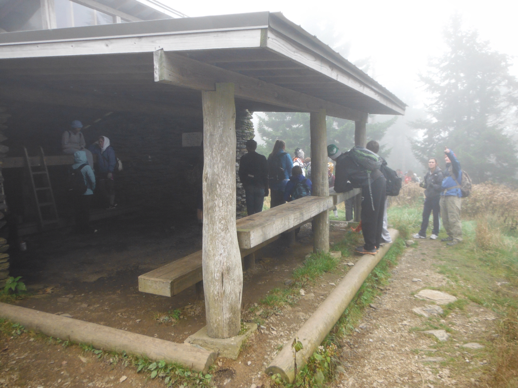
Tricorner Knob Shelter in warmer weather
Once I heard the hiker's name yesterday, I was able to find his blog about his adventures along the Appalachian trail this summer and fall. It seems he left Maine in June, hiking south. He was in Hot Springs, NC this weekend, apparently heard there might be some snow, but set out for Newfound Gap, expecting only 6 or so inches. Somewhere along the way the superstorm, Sandy, turned those 6 inches into several feet of snow! It appears he spent at least one night at Tricorner Knob (he posted a picture of his gear spread out in the bunk there) and must have been on his way to Pecks Corner when the drifts made it impossible for him to travel further. Luckily, he had enough cell phone service to make at least two 911 calls to set the rescue mission in motion and then yesterday morning, let them know he had survived another night. News sources report that rescuers attempted to reach him by foot, but the going was too difficult and the winds still very high. A Tennessee Highway Patrol helicopter then apparently put men on the ground at Tricorner Knob. They were then able to find his footprints leaving Tricorner Knob and followed them to his "camp" about a mile away and airlift him out. Video footage on a Knoxville news station showed this hiker, only two years different in age from me, walking out of the helicopter and sitting on a gurney to be transported to LeConte Medical Center for treatment.

I was so thrilled to see him walking. I was fearing extensive frostbite. I surely hope the extent of his injuries is minor and that he is able to recover fully. He is so very close to his goal. Even if he doesn't finish this year, if he can recover fully and still wants to, at least he will have that option at some time in the future. I am thankful that he is alive and safe now. My thoughts are still with him and his family as they all recover from this ordeal. Good luck, Solo! Godspeed!


Sunday, October 28, 2012

Riding the Cade's Cove Loop Road

Check another one off my bucket list! I have been wanting to ride the Cade's Cove Loop Road for years, but have just never had the chance. Yesterday, my husband and I got up very early, loaded the bikes, and headed up to the Cove. I was under the impression that the Loop Road was closed to automobiles on Wednesday and Saturday mornings, which is true during the summer months, but I was sadly misinformed yesterday. When we topped the hill on Laurel Creek Road and made our way toward Cade's Cove, we encountered a line of cars, only a few of which were adorned with bike racks. That was my first clue that all might not be as expected.

We arrived a few minutes before 7:30, apparently just a short time before the Park Rangers unlock the gates to both the Loop Road and the Picnic Area. After parking the truck and unloading the bikes, we headed up toward the gate where we were dismayed to see cars streaming through undeterred. We debated not riding, but we had come a long way and gotten up so early, we decided to try it anyway. I knew there were two roads that cut across the Cove to shorten the loop and figured that if the traffic was a problem, we could always take one of those to end our ride early. I was just sure I would be terribly in the way of the cars and would constantly feel like they were pushing me or waiting to get around me, but, oh, was I wrong!

The day broke to clouds and a little mist, but not enough to make the ride uncomfortable. The temperature was about 55 degrees when we got out of the truck. I was pleased with this because the forecast I had checked the night before said the high in Townsend would be 50 degrees on Saturday, so this was already warmer than I had expected. Sugar maples were still ablaze as we made our way through the open fields and shady woodlands of the Cove. Deer were not as prolific as I had seen in the Cove on many other occasions, but we encountered many more turkey than I've ever seen before in any one location. Seems like every turn we made, we'd find a few more turkey. They were definitely traveling in same-sex groups--hens in groups and gobblers in groups. We saw as many as ten gobblers together picking in the open fields very much unlike the wary, skiddish animals they are in less protected areas. It's funny how animals within the Park seem to know that no one can shoot them in their own special paradise.


We did see one majestic buck grazing under a tree near one of the churches along the Cove Loop Road. He seemed to have come out of the woods for the express purpose of posing for photographs on this cool, damp morning. Photographers had flocked to the Cove to capture the last show of color in the Park as the leaves began to fall in preparation for November's rapid approach. They were massed around this buck, cameras and tripods at the ready. He, however, was nonplussed by their presence or the flashes that emanated from those cameras. I've noticed lately that when I'm tired, my camera hand is far from steady, and although I took several pictures of this nice buck, only one of them was clear; the others were blurred by my inability to hold said camera still as my muscles quivered after a long pull up one of the hills interspersed along this road. This photograph is poorly lit, but perhaps you can still get a sense of how beautiful this buck was.

I absolutely love riding my bike, but riding it in the splendor of one of the most beautiful places on Earth clad in her fall colors was a special treat indeed. Although it was a little past peak, there was still enough color to dress the fields in golds and reds as even the native grasses added to the show. The only thing that detracted from this day was the presence of those cars. I thought I would be in their way, but on the contrary, they were in mine! Invariably, when approaching a long hill or steep incline, cars would stop to look at something (and I can't blame them for this!), but it sure made it harder to ride those inclines. There was more than one time when I think I could have ridden up the incline had I been able to begin it with some momentum. Starting from a near stop or a dead stop though, at least for me, makes those long hills next to impossible. However, even walking up those hills just gave us a little more time to slowly enjoy the beauty of the Cove, the quiet of her open fields, and the solitude of her woodlands. I cannot think of a better way to spend a Saturday morning!


Wednesday, October 17, 2012

Mt. LeConte Shared and Magnified!

On Wednesday of this past week, I took probably my favorite trip to the summit of Mt. LeConte because I shared that experience with 25 teenagers, many of whom had never hiked at all. LeConte has been one of my favorite spots on Earth for a year and a half now, since I first hiked to the top in May of 2011 via Alum Cave Bluff Trail. I went again this spring with a larger group of ladies this time via the Boulevard Trail. On the first trip, the weather was perfect with crystal clear blue skies and visibility that stretched literally for miles. The second trip was less stellar for a couple of reasons, but was enjoyable nonetheless. This trip, however, I do believe was my very favorite because I shared this special place with my students.

We loaded the bus at 5:30 a.m. in the parking lot of our high school. Believe me, that's early for 16 and 17 year olds! They complained of having to get up so early, but I noticed they were smiling and even a little giddy with excitement. Armed with pillows and blankets in addition to their hiking gear, the kids piled on the bus and promptly went to sleep. We arrived at Sugarlands Nature Center for our final "real" bathroom break a little before 7:00 a.m. At that time, I also divvied up the supplies that I had brought for all of them. I've already mentioned in a previous post that Blue Ridge Mountain Sports in Knoxville, TN donated 44 Clif Bars for the students. Our local Food City donated bananas for everyone to have during a break on the trail. I always find that bananas can give me that little extra shot of energy when I begin to drag a bit. Also, Earth Fare provided 48 bottles of water for us to distribute to the kids. Most of them did not have a water bladder for their packs and I wanted to be sure they carried enough water with them to the top. These supplies were greatly appreciated and made for a much more enjoyable hike for these students.

Once I distributed the supplies and handed out homemade blueberry and/or pumpkin muffins made by a fellow teacher and one of the chaperones as one last bit of nourishment, the bus took us our last little distance up to the trailhead. I was simply thrilled to be ready to head up the trail just after daylight at approximately 7:30 a.m. The kids were so cute getting all their gear on. We talked about expected behaviors and trail etiquette, and then we embarked on what would be an almost perfect day.

The morning was brisk, and most everyone started out in fuzzy fleece jackets, sweatshirts, or even heavier coats. After about a mile it was time for a stop to shed some layers. We were definitely warming up, making gloves and jackets unnecessary. I was really surprised at how quickly we arrived at Arch Rock. We were making good time, but this hike was never supposed to be about speed. I loved overhearing the kids when we would come to a river crossing. They didn't quite know what to think about those footbridges made of a log and one handrail. They crossed tentatively and nervously, but they crossed! At one point along the trail, one student said, "What's that smell?" One of the other chaperones replied, "Nature!" I got a little thrill knowing that this student had never been in the Smokies before and that all of this wonderful natural world that I take for granted was a totally new experience for her. Numerous times that day, students would remark about something beautiful or unexpected and my heart did little flips. It made the 5-mile walk up there almost effortless. The students did a great job. Even though I was in the back with the group of girls who were the slowest hikers, they did not complain. They got tired, and I let them take lots of breaks, but when I told them we needed to get moving again (because we were getting cold), they got up and hit the trail again. They didn't ask me how much further more than maybe 20-30 times. :)

As long as we kept hiking, our temperature was fine even though you could tell it was getting much colder as we gained in elevation. At about 9:00 a.m. we stopped to regroup at Alum Cave Bluff and take a snack break. I wanted to be sure the students stopped long enough to get some good nourishment (the bananas and Clif Bars) and drink plenty of water. If you know teenagers, you know how they will cave in to peer pressure--even the peer pressure to walk faster than they need to without taking breaks. This rest and refuel break was mandatory and it was good to get to see everyone in the group together and assess our condition at the half way point. It appeared that everyone was still in good spirits and most were ready to finish the deed soon after stopping to rest. We didn't stay too long because we were beginning to get cool again, and we were soon making the climb along the rock walls where cables bolted into the mountain walls provided my students with handholds and me with peace of mind.

We had gotten some great photo ops on the cliffs just before the Bluff, but shortly after leaving the Bluff, we ascended literally into the clouds and that's where we remained for the rest of the day. It never did rain on us, but my hair sure looked and felt like it had. It was soaking wet from the condensation within the clouds. I was disappointed that the views were obscured, but the girls in my group were fascinated with the fact that they were INSIDE a cloud!

The mile and a half or so above Alum Cave Bluff is the most difficult part of the hike and some of these kids were struggling a bit at this point. I never really worried about them not being able to make it, and they still weren't complaining. But the breaks became more frequent and once one of them complained of being lightheaded. After another break, this time with some more food and water, she felt better and we continued on. Soon we arrived at the point in the trail where the ecosystem changes dramatically and you just know you are nearing the top. Many of my students said that last part of the forest right before you get to the lodge area was their favorite part of the whole trip.

I have a feeling though, that for most of them, the favorite part was the lodge itself where they could sit by the fire, rest, and drink some of the most delicious hot chocolate found anywhere on the planet! That $3 is the best money I've ever spent, even the third time around! While we were resting and relishing the fact that yes, we had indeed climbed Mt. LeConte, we were met by Tim Line, the man who runs the LeConte Lodge. He had agreed to talk with my students about the precautions that the lodge and the Park Service are taking in light of the hantavirus outbreak in Yosemite, which was (at least in part) the reason we had made this trek. We moved into the "office" area where the shirts are sold. My kids gathered around the fireplace in the center of the room while Tim told us all about the deer mice that are a part of the LeConte experience and what his staff and the Park Service are doing to keep visitors safe. There has never been a case of hantavirus in the Smokies; apparently this is attributed to the moist and humid environment in our area as compared to the dry region in and around Yosemite. This humidity keeps the feces and urine particles from becoming airborne which is how they are transferred to humans. We were also joined by a Park Ranger who apparently made his way up to LeConte just because he knew we were coming to learn about the risks and preventions of hantavirus in the Smokies. He, too, did a marvelous job explaining the Park Service's position and policies relevant to hantavirus here in our own backyard. Both of these gentlemen gave my students plenty to think about and investigate further. They also treated the kids respectfully and took their questions seriously. We also received an email the next day expressing interest in any findings or proposals the students may develop as a result of their investigations and research. After meeting with these two gentlemen, we made our way up the trail a quarter mile or so to the LeConte Shelter so the kids could see what a backcountry shelter looks like considering that they, too, are visited regularly by the deer mice that may be infected by the hantavirus.

These students will continue to work on the scientific research behind our trip to the summit of Mt. LeConte in the coming month, and will put together presentations and proposals to share with the Park Service and perhaps the Friends of the Smokies, but I, and hopefully they, will forever cherish our time on the mountain. I know that this mountain will always hold a special place in my heart because of this experience. Someone once said, "Joy shared is joy magnified." The same thing definitely holds true for this magical mountain.


Sunday, September 23, 2012

Blue Ridge Mountain Sports Steps Up!

I just wanted to take a minute to share with you that Blue Ridge Mountain Sports in Farragut has stepped up to donate 35 Cliff Bars to the hike I wrote about in the last blog entry.

If you are in need of gear soon, stop in Blue Ridge Mountain Sports on Kingston Pike and let them know you appreciate their support of getting youngsters into the great outdoors. I know I will!

We are still in need of water bottles, Gatorade or Powerade, and monetary donations to purchase the kids an "I Hiked It" shirt at the top. If you have any ideas, feel free to share them with me.

Tuesday, September 18, 2012

Call me crazy! Field trip to Mt. LeConte!

I may have totally lost my mind, but I just received word that my field trip request to take my Microbiology classes to the summit of Mt. LeConte has been approved! What that means is that I will be taking approximately 35 high school students on a 10-mile hike up and back on Alum Cave Bluff trail.

I am so proud of these students. I asked them to do some research on current events in the field of microbiology and several of them began discussing the emergence of the hantavirus out of Yosemite National Park and what a scary scenario that is. Hantavirus is carried by rats and mice; humans are exposed to the virus by breathing in dried feces or urine particles that are in the air in rodent-infested shelters and cabins in Yosemite. According to what I have read recently, this disease is lethal approximately 40% of the time, and survivors may suffer debilitating symptoms long after they have "recovered." My students began making the connection between the rat/mouse infestations in Yosemite Park shelters and cabins with conditions in the part of the Smokies with which some of them are familiar. They wondered if a rodent control program is in place in the LeConte cabins as well as in the shelters along the Appalachian Trail in Tennessee.

My students quickly decided that, as a part of our course work in Microbiology, they wanted to think like epidemiologists and investigate the conditions in Yosemite which have allowed the hantavirus to become such a problem and look at ways to prevent similar conditions from developing right in our own park. From that arose the idea that we would actually visit Mt. LeConte to gather information for their project. While we are up there, I hope to be able to get LeConte Lodge employees to meet with my students and provide some insight to whatever programs are in place relevant to rodent control or explain to my students the impediments that prevent such programs. I truly hope that park or lodge employees will appreciate the real-world relevance that such a project provides for these students and will honor my request.

What else does that mean? It means that I will be able to expose these students to the grandeur and beauty of one of my favorite places on earth. Mt. LeConte is special in many ways. The challenge of the hike up will encourage these kids to get in shape to the best of their ability between now and the day of our hike. The accomplishment they feel when they reach the summit will stay with them forever, as will the views they will experience if we are blessed with good weather at the top. It also means that many of these kids who have never even been to the Smokies, although they are practically in our backyard, will get to take what could turn out to be the trip of a lifetime!

I will be looking for some corporate sponsors to help us purchase things like Clif Bars, bananas, and water bottles. I'll also be looking for a company to provide breakfast biscuits and juice or milk for us to eat on the bus ride up to the trail head. In addition, I would LOVE for someone to donate enough money to purchase each student one of the "I Hiked It" shirts available at the LeConte Lodge store!  I'll let you know who steps up and helps us out with this. The transportation and other expenses are more expensive than I thought they would be when I first considered the idea. If you have any ideas, please feel free to share them with me as I try to arrange a trip these kids can afford and will enjoy. Also, if you don't mind, pray or hope for great weather for us! :)