Saturday, October 3, 2015

Tackling the Long Hungry Ridge Loop to Gregory Bald

As we are closing in on our goal of completing all the trails in the Smokies, there's one trail we had been putting off for various reasons. That is the "lollipop loop" out of Twentymile to Gregory Bald and back down. We are pretty used to a 17-mile hike at this point in our venture, but this 17-mile loop meant climbing up some pretty steep trails to get to one of my favorite spots in the Park, Gregory Bald. We had also read the story in the Brown Book about a group of bear hunters from long ago who had once been stranded by high water on that side of the mountain and almost starved before making their way out. Many times we had decided not to do that loop because of recent rains or impending weather. Other times, we had just opted to do something else because of that climb. This time, we were really about out of options.

We had tried to figure out how to do it from the Cades Cove side and do it as a shuttle. In fact, one time I had even contacted friends who had said they'd be willing to do shuttles for us, but even in talking it over with them on the phone realized just how silly that idea was--that is one tough shuttle. What we needed to do was to suck it up and JUST DO IT, as Nike would say! And that is what we did! At least we picked a gorgeous day in which to make the attempt!


This loop begins at the Twentymile Ranger Station on the Twentymile Trail and comes complete with a warning of bear activity. Within just a few minutes of walking, you come to the intersection with Wolf Ridge Trail and at this point, a decision has to be made. Options are to climb up Wolf Ridge Trail for 6.3 miles and arrive at Sheep Pen Gap after an ascent of about 3300 feet (most of the climb is in a 3.5 mile stretch). I had assumed that is the path we would take. The other option is to go up Wolf Ridge for just a little over a mile then travel across the bottom of the loop first on Twentymile Loop Trail for 2.9 and THEN begin the real ascent on Long Hungry Ridge. This direction of the loop takes you up another really steep climb in the middle of Long Hungry, but it happens after you've already hiked 4.5 miles before you start it. Then at the top of Long Hungry, you are faced with the brutal .7 mile section of Gregory Bald Trail that takes you out to the bald. When final decision time came, we deferred to Liz Etnier, author of Day Hiker's Guide to All the Trails in the Smoky Mountains. She told us in her book the loop was a little easier going up Long Hungry, so that is what we did. I don't know if she is correct in her assessment, but we survived it, so all is well.

I do love hiking this time of year. The fall wildflowers adorn the trails and give reason to pause and snap a few shots. The only problem is, there are so many of them that are not in my two wildflower books, I do not know their names. I can, however, still enjoy their beauty! In addition to the flowers, the trees are also beginning to put on their colorful show. At the highest elevations, the leaves were just beginning to turn, giving hope that the hot summer was indeed fading away.


After our recent encounter with Mama Bear on Hazel Creek Trail where we were bluff charged twice, we were mentally prepared for bear again. Coming out across the Twentymile Loop Trail, we did hear bear on two different occasions in the woods a good distance off trail. Those bears, we never did see. There was one unnerving moment near the end of Twentymile Loop though, that we heard a screaming in the distance that wasn't human, but echoed of terror and pain. I have no idea what that sound was and I hope I never hear it in the woods again. Needless to say, we quickened our pace significantly. There would still be one more bear encounter on this day.


Backcountry Campsite #92
The early stretch of Long Hungry Ridge was a pleasant rise through the forest which passed by Backcountry Campsite #92. This is a site I would like to remember. It's a large campsite with lots of downed trees to sit on and lots of places to pitch tents, nestled near a creek which provides freely flowing water. This would be a nice site to revisit for a campout sometime.


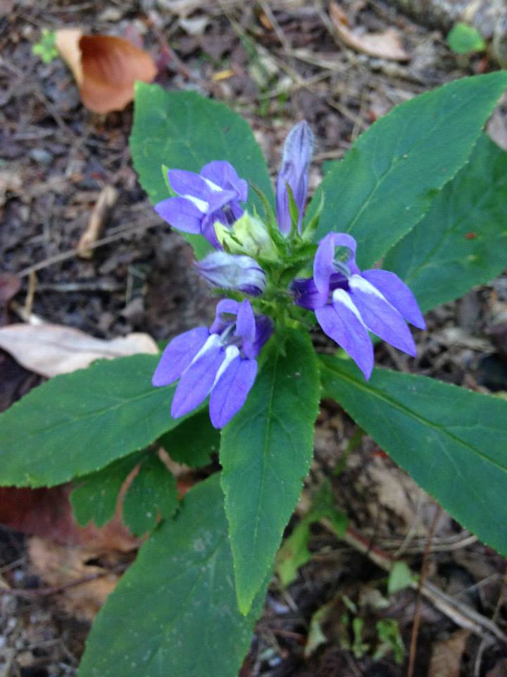
The Rye Patch on Long Hungry Ridge


Just past 92, though, the trail took a definite turn, seemingly straight up! The condition of the trail was fine except for a bit of overgrowth near the top which at least helped with the climb, but I would be lying if I told you I wasn't struggling by the time I reached the top. The occasional view of trees beginning to be clothed in their fall finest was a welcome respite from the continual incline.  The sight of that flat spot at the top known as the Rye Patch was pleasant indeed!


Leaves beginning to turn at the top of Long Hungry.


The bulk of the elevation change now behind us, we made a quick trip to the end of Long Hungry Ridge and were soon met by the trail sign for Gregory Bald Trail with the inscription that we were now only .7 miles from the top. However, we'd been here before, so we were well aware that that .7 was going to be tough as tired as we already were. Pressing on with our eye on the prize, we trudged up Gregory Bald in anticipation of it opening up to the almost 360 degree vistas that we knew awaited us.  The mantra that goes through your head when your body is spent but you know you are almost there is a dialogue of sheer determination. "One foot in front of the other!" "You CAN do this!" "Almost there!" "It's going to be SO worth it!!!" And, indeed, it was!

Soon the trail opened up to what we had been looking forward to all day! Expansive vistas overlooking Cades Cove on a stunningly beautiful day!


Every time I travel through Cades Cove, I look up to Gregory Bald and think how I have stood there on that bald spot on the top of that ridgeline. This day, I stood on that bald and envisioned myself down in the Cove. It's a good feeling, especially after making the more difficult climb up out of Twentymile. What a day! 

I could have stayed up there all day, and one day I do want to spend the night up there to see sunrise/sunset from the bald, but on this day, we still had miles to go before we slept. After enjoying lunch on the bald and soaking up the views for a short time, we began the descent down Wolf Ridge trail. It seemed much like Long Hungry Ridge, so I'm not sure which would have been the easier direction to have done this loop, but it really didn't matter now. The highlight of our descent was coming up on another Mama Bear and her cub. This time, they were together (thankfully) and above us on the ridge eating acorns from the forest floor. Little cub saw us and quickly scampered higher on the ridge. I'm quite sure Mama saw us, but she was too busy gorging herself on the mast to pay us any attention. She just kept on munching which was exactly what we wanted her to do. We moved out of their way and never did get a good picture. 
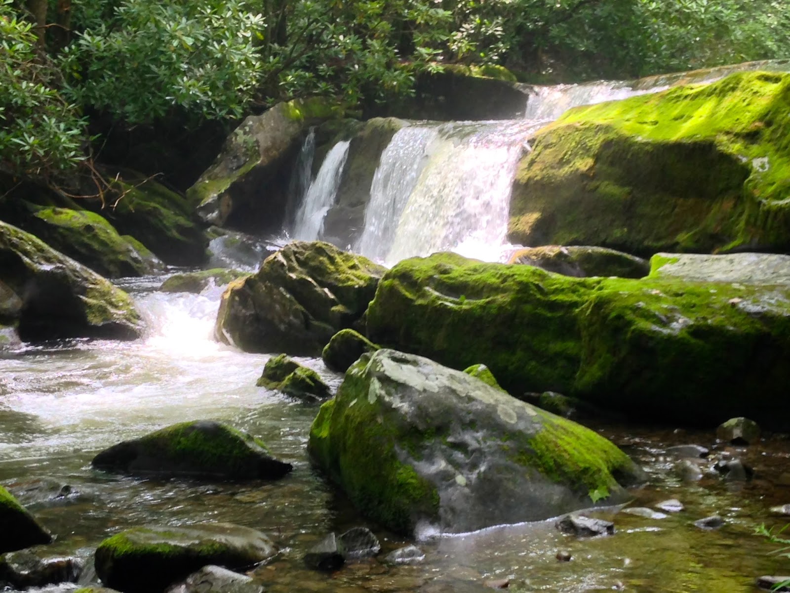
Wolf Ridge comes alongside Dalton Branch about half way down and the rest of the hike includes those glimpses of cascades and the sounds of rushing water that create such peace along a creekside hike--not a bad way to end the day. As the sun became lower in the sky, contrasts in the forest stood out and it was obvious that days are getting shorter. Fall is upon us, so many of our long remaining hikes to reach our 900 will have to wait until spring. Perhaps if weather will cooperate, unlike it did today as I sit writing about hiking instead of hiking in the torrential rains associates with Hurricane Joaquin, we can still get a couple more in this fall. One of us was supposed to have finished today, but that will have to wait. Maybe next weekend! Here's hoping!


Sunday, September 27, 2015

Spiders and Snakes on Lakeshore Trail in August


Fontana Marina at Daybreak

Over the last six weeks or so, we've done quite a bit of hiking, but since I'm also back at work, I've done very little writing! This late summer season began with a hike along Lakeshore Trail, from Pilkey Creek back to Campsite #90, just past Eagle Creek. That hike commenced and ended with a boat shuttle out of Fontana Marina, and I found myself thoroughly enamored by beginning and ending a day of hot, humid, tiring hiking by swiftly skimming across Fontana Lake, surrounded by the very mountains I've spent so much time hiking in over the last four years. I must admit, though, that watching our pontoon boat transportation pull away from the shore and leave us in the middle of nowhere was just a tad unnerving. There was nowhere to go, now, but up the trail to where he would meet us in the evening to take us back to our car.

In summer, Lakeshore Trail is hot and dry due to its lower elevations and is prime habitat for all kinds of spiders, bugs, and snakes. We encountered an untold number of spiders and two, thankfully, fairly docile timber rattlers along this section of trail.

If you look closely in this photo, you can see the head of a large timber rattler just below the branch that stretches across the top of the picture. If you follow it along down and to the right, you can see its rattlers raised at the other end. He was a good four and a half feet long and when we first saw him, he was headed down the trail directly at us. Jennifer and I were alone on this hike, and she was in front. Neither hiker nor snake saw the other until it was almost too late! She was well within striking distance when that sound...that sound that strikes fear in my heart...that unforgettable, immediately recognizable rattle...erupted from the middle of the trail within just a few feet of Jennifer's hiking boot. After an instantaneous retreat, Jennifer and I waited patiently for the snake to decide he didn't want to be in the middle of the trail anymore. Within a couple of minutes of us talking to and stomping our feet at him from a considerable distance, he zigzagged up the hill to the left of the trail and allowed us to pass. We thanked him profusely as we passed for being such a good and accommodating boy! I would be lying though if I said we didn't spend the rest of the hike scanning the trail for more timber rattlers. Fortunately, he was the last one we saw or heard.


Probably my favorite part of this hike was the little town of Proctor through which the Lakeshore Trail passes. So much history is here in what once was a booming logging town on the banks of Hazel Creek. We were able to spend a few minutes wandering around the old Calhoun house and having a snack on the front porch while looking out over the rippling waters of Hazel Creek. What a wonderful place to grow up that would have been! It does make me sad knowing that folks were forced to give up their family homes to create the Park. I am appreciative of their sacrifice every time I come across old remnants of homesites back in these woods.


Lakeshore Trail made its way along through the dry forest until coming to Campsite #90, which is a large and well-used site. There were quite a few tents and people there including some folks canoeing in the inlet. Looked like a wonderful way to spend an afternoon! We arrived at the campsite with enough time to spare to finish the small connector up to Lost Cove Trail which we did in just a few minutes. We had been a bit worried about not having time for that since we had also, without having planned to, done the little Ollie Cove Trail that we stumbled on earlier in the trip. Just as we returned to Campsite #90, our shuttle pontoon arrived to pick us up. Our timing couldn't have been more perfect.

I will say that Lakeshore Marina does a nice job shuttling hikers (and fishermen too, so I hear) across the lake to the parts of Great Smoky Mountains National Park rendered unreachable by the creation of Fontana Lake. The shuttle prices are reasonable, and the captain was nice and also informative. On our way back to the marina, he shared stories of the hikers he carries and pointed out places of interest along the peaks of the mountains that drop into the lake. He knew and showed us the location of Spence Field, Shuckstack Fire Tower which you could see along the crest of the mountain, and other trails and peaks in which he knew we would be interested. Thanks, Captain, for such a great way to end our hike!

Thursday, August 13, 2015

The Perseid Meteor Shower from Top of Ole Smoky

On top of ole Smoky, all covered with...STARS! I had planned for over a week to try to find a time to catch the Perseid meteor showers. As soon as I found out it would occur during a dark phase of the moon so there would be little light interference from the man in the moon, I knew this was my year to make it happen. I had been wanting to catch it for years, but it had just never been a priority. This year, I made it one!
Photo Credit: Kevin Adams of kadamsphoto.com
My daughter, Kacey, and I, along with a friend of hers, made the hour and a half trip up to Newfound Gap, on the evening of August 12, 2015. I knew I had to work the next day, so we left home about 9:30 which put us at the Tennessee-North Carolina state line at a little after 11:00 p.m. As many times as I have been up that road and to the parking area at Newfound Gap, I guess I had never been there when there was no moon. Even before my eyes had time to adjust to the darkness, we were seeing not only meteors, but an unfathomable number of stars! Even without the Perseids, this view would have been worth the drive and the loss of sleep. I don't know how many nights I have spent camping out or backpacking in these mountains over the last 50 years, but I guess I had never been out in the open that late at night, especially on a dark night. I have never seen anything like that in all the time I've spent in these mountains! The Milky Way stretched out from the North Carolina side of the Smokies, crossed the Newfound Gap parking lot, arched over the Appalachian Trail, and reached on into the hills of East Tennessee. Gazing up into this speckled canvas of grandeur, we watched as streaks of light zipped past us or over our heads as bits of comet debris entered the Earth's atmosphere at over 130,000 miles per hour and became flaming orbs of natural fireworks. We didn't even attempt to count the number of "shooting stars" we saw, but it must have been 40 or more and often we would hear others exclaim about one that we had missed. You simply couldn't look everywhere all at once! 

There's still time to catch this sight for yourself. Find a place, any place, away from the lights of cities and towns. Seek it out! Experience it! I promise, you'll never forget it!

Tuesday, July 14, 2015

Curses! Foiled Again!


There's a stretch of the Appalachian Trail that has become my nemesis of late. I should have completed it last year with Jennifer and Kirsten on our backpacking trip that is traditionally scheduled just as soon as we get out of school each year. That trip was to have been from Clingman's Dome to Fontana Dam done over the course of three days. But last year, I was injured just a couple weeks before the trip, and my knee just wouldn't go on a strenuous hike yet. The girls went ahead at my insistance; I even dropped them off at the trailhead. But I missed it. So this past weekend, Jennifer had graciously agreed to do the stretch of the Appalachian Trail between Rocky Top and Derrick Knob with me as a one-night trip. I was excited to go up and over Thunderhead Mountain!

We left early Friday morning to drop one car at Middle Prong trailhead and then drive the other car up to the large parking lot at Cades Cove Campground. We had debated going up Lead Cove to Bote Mountain and accessing the AT that way, but we decided that since we were leaving early, Anthony Creek Trail would be a nicer walk since it would be alongside water some of the way and put us out on Bote Mountain with less of that trail to travel. We did realize that this path would be a bit longer, but decided it would be a good trade off. Bote Mountain is not one of my favorite trails, especially in the summer. Heat and gnats are constant companions on that trail.


When we arrived at the parking lot at Cades Cove, we had planned on just walking over to the back of the picnic area from whence Anthony Creek trail departs the Cove. Just as we were getting ready to take off though, a school bus about half full of middle school aged children pulled up and an adult got off to fill up some water bottles. Hey, what could it hurt to ask, right? I walked over to the bus driver and asked if he'd give two backpackers a ride to the back of the picnic area and he was more than happy to oblige! We climbed aboard the bus, appreciative of the lift. When we pulled up at the trailhead, a doe was picking her way through the woods just behind the trail sign, so the kids got to see a deer they wouldn't have seen if they hadn't given us a lift. It worked out great for everyone and they were very excited to see a deer that close.


Anthony Creek is a really nice trail! It crosses over its namesake several times, sometimes on large bridges and sometimes on footlogs, but it never requires a wet crossing. Most of the lower couple of miles is within view and/or earshot of the creek which always makes for a pleasant hike.


Even when we were not near the creek, the trail was lined with beautiful mushrooms and wildflowers in bloom. Bee balm is in bloom lots of places in the Park, but there were many other summer wildflowers blooming, most of which I cannot identify.

We had left early that morning, in part to beat the heat, which we did for the most part. As we reached Bote Mountain Trail, the humidity was beginning to build and become uncomfortable, but by then, we were almost done for the day. With only 1.7 miles to do on Bote Mountain, we made good progress up that steep and rocky stretch and before we knew it we were at the intersection with the Appalachian Trial and finally up on a ridgeline which is where I love to be--MOST of the time!  This day was absolutely gorgeous with only a few puffy white clouds in the sky as we passed through what remains of Spence Field.


This former pasture where stock were grazed in the days before the park became the park is now not being maintained as a bald, so it is in the natural process of returning to woods. This in-between stage is lovely in many respects. In places the field is still fairly open and there are glimpses of what must have once been spectacular views. In other places, tall grasses grow in large clumps under the protective arms of some type of tree that I do not know the name of. If any of my readers knows what they are, I'd love to know. Please put it in the comments below.


For our destination on this first day, the remainder of the hike was very short as we made our way down to Eagle Creek Trail and the .2 mile stint down to the Spence Field Shelter.  It was only about 1:00 p.m. as we dropped our packs and visited with the two young men who had been resting there when we arrived--one a member of the Army (on leave) and the other his nephew. They left after a little bit going on further up the trail.


Shortly after they left, another pair of men came through, stopping for lunch. They brought with them a real surprise! Chicken of the Woods!

The older of the two men sat at the shelter table, got out a couple of large chunks of the wild mushroom, and began to educate us on how to look for it and how to cook it.


He carried with him some olive oil in a packet he purchased from www.minimus.biz. I had never heard of this site, but they do offer many products in very small size packaging, so it might be of use in the future. I usually just stop at Subway and pick up some olive oil packets when I need them for backpacking.

He prepared the shrooms in his camp stove and then graciously offered some to us, so we had to try them. He told me they would taste like a combination between chicken and scrambled eggs.  I guess he was right, but I'd rather have either chicken OR eggs instead! But you only live once, right?


Spence Field shelter is a great place to spend a night. Because of its elevation, it provided us with a nice respite from the heat and humidity in the Tennessee Valley. The shelter is roomier than most, especially in the design of the sleeping area. In this shelter, the upper bunk is higher than is typical, so we actually chose to set up on the bottom bunk area with plenty of headroom and no need to climb the stairs. There's also a strong running water source which is encouraged to pass into and through a pipe which makes it easy to fill water filter bags. I was also surprised to learn that there was a privy there! What a nice surprise indeed!


With all of the extra time we had on our hands that afternoon, I spent some of it going through the shelter register where thru-hikers and others had made notes of their journeys.  One that I found was really cute, so I took a picture to share it with you here:


Seems like thru-hikers may be safe, but weekenders really need to be sure to hang our food!


The fact that we had done this leg of the hike on the first day meant that we would only have about 15 miles to do on our second day.  Having arrived at the shelter early in the day meant that we would be fully recovered from our climb up to the AT (which is never easy no matter which trail you do it on). We decided that we would get up early in the morning, pack up and head out before having breakfast so that we could make it across Thunderhead before the heat of the day. There was also a forecast of storms for later in the day, so in doing it this way, we would have time to get to Derrick Knob before the heat built up and thunderstorms could materialize. At least, that was the plan.

In reality, when we awoke on Saturday morning, I knew our plan was suspect. We were totally surrounded by fog. As we got up and began to pack, a cool wind rustled through the leaves of the trees which envelope the shelter. We were afraid that wind was blowing in weather which would not bode well for us crossing that exposed ridgeline to Derrick Knob. We were out of the shelter by 8:00 a.m. We made a quick trip back across Spence Field and made the climb to Rocky Top hoping that the weather would break and the skies would clear.

The REAL Rocky Top!


So far there was no rain, so I was hopeful that the fog would burn off and we might get some nice views as we crossed over Thunderhead Mountain. We sat at Rocky Top to eat a protein bar to give us energy to make it up and over. I had taken about three bites when the first round of thunder roared. I immediately lost my appetite, put the remains of my Clif Protein Bar away, then reached down to shoulder the pack and hike on. Just as we got past Rocky Top, which would have been the beginning of new miles for me, more thunder rolled, this time closer. I knew in my heart that the thing to do was to play it safe and turn around. My understanding was that much of what lay ahead was exposed to the elements which, I've heard, are much magnified from weather that might be happening below. I walked only a short distance when I turned to Jennifer and told her I thought we might should go back down the way we had come up.  After a little discussion, she wanted me to make the decision since it was new miles for me. We finally agreed to play it safe. I was crushed!


Once we had made the decision, we made quick work of the trip back to cover on Bote Mountain Trail. We kept talking about what a good time we had had at the shelter, and how even though we were disappointed, we were glad that we had made the trip. And all that is true! I am very glad we made the trip to Spence that night and had enjoyed the company of several other hikers at the shelter. But I cannot help but be disappointed that I still have not accomplished that stretch of trail. All I could think of while hiking down the trails back to the car waiting for us at Cades Cove was the Snoopy and the Red Baron song. "Curses, Red Baron! Foiled again!"

Tuesday, July 7, 2015

Morning Meander up Middle Prong


Yesterday I was blessed to "take a hike" with a friend whom I met, electronically, through blogging several years ago. While my usual map-marking hiking partners were both out of town, I found myself missing my mountains after having spent the previous week in Isle of Palms and Charleston, South Carolina. I had recently discovered through Facebook that this blogging friend of mine, and I only lived a few blocks apart. Sharon has been through a terribly difficult time of personal loss, so I thought this might be the perfect time for us to take a walk in the woods together, something we both love. Although I felt like I have known her for several years by reading her blog, Gains and Losses: Life Through Sharon's Eyes, we had never met face-to-face, but what a wonderful time we had carrying on our friendship in real time!


We decided on a simple walk up Middle Prong Trail, but it turned out to be much more than that! When we crossed the large bridge spanning Lynn Camp Prong at the beginning of the trail, I wondered aloud where the side trail that branches off along Thunderhead Prong might go. Sharon said there was an old metal bridge up there, and I got probably a little too excited! I am beginning to love finding treasures that are a bit off the beaten path in my beloved Smokies. The wide, pleasant trail that I had always thought was just a fisherman's path must get a good bit of foot traffic at least until the bridge. It ambles up through the woods flanked by large rhododendron bushes and within earshot of the babbling of Thunderhead Prong.


Within probably a third of a mile from the Middle Prong trailhead, the bridge makes its appearance as the trail makes a hard right turn to cross the creek. What stands before the unsuspecting hiker is a bridge unlike anything else I have ever seen in these mountains! This single-file metal bridge has steel cables and metal posts for handrails. Although it at first reminds you of a swinging bridge, this structure is extremely sturdy as it crosses over old stone buttresses. There did appear to be one welded connection about midway across, which gave me just a second's pause, but this bridge isn't going anywhere anytime soon.


The bridge is even prettier looking back on it from the opposite side once you have crossed over it. The path continues on past the bridge, but we did not walk up it except for just a few feet. Apparently this old, unmaintained manway makes its way up around Defeat Ridge, and on up to Thunderhead Mountain. When I learned this while doing some research after returning home,  I was instantly curious about Defeat Ridge, how it got its name, and the history of this path. Hiking in this area is an off-trail adventure that may be beyond me, but there are folks who have been up there and know of the secrets that part of the park still holds. Maybe someday I will explore some of that region--it intrigues me, that's for sure!

Making our way back to the trail we had come to hike, we took time to photograph the beautiful Rosebay Rhododendron blooms which adorned our path.
Once we returned back to Middle Prong trail, we began the delightful walk along Lynn Camp Prong. I found myself watching the water, looking for the sleek shadow that might be a brook trout waiting for its next meal within view of the trail above. I have hiked this trail many times and fished it a couple of times since the park service has reopened it. This stretch of water has been home to the Brook Trout Restoration Program which required the creeks involved be closed to fishing while the rainbow trout were removed and self-sustaining brook trout populations established as they had existed before the introduction of the non-native rainbow many years ago. They may have seen me because I never did see any of them.

The agenda for this day though, was simply an easy meandering up the trail, appreciating the scenery and enjoying the company of new friends. I must say, it was relaxing to just walk up the trail, taking time to look at the massive rock walls which line the trail in some places, or stopping to appreciate the numerous cascades abundantly scattered up Lynn Camp Prong. Map marking has become an all-encompassing obsession, but this hike was enjoyable simply because we were not worried about keeping a certain pace or going great distances. The cares of the world could melt away and be forgotten in the rapids and runs, bubbles and babbles of the creek beside the trail.


In an effort to regain normalcy in her life amidst tragedy, Sharon has set a goal for herself and on this walk we would attain the first accomplishment toward that goal. She is using a book written by Johnny Malloy titled Hiking Waterfalls in East Tennessee: A Guide to the State's Best Waterfall Hikes which lists 100 of the most scenic waterfalls in our state. Some of them are in our cherished Smoky Mountains, and she checked off this first one on our hike. I was pleased to be there with her when she took this first step toward her new goal.


I do think it's a pretty cool coincidence that when I was looking for the story behind the name of Defeat Ridge I found my answer in a book also written by Johnny Malloy almost 20 years ago. According to Mr. Malloy in Trial by Trail: Backpacking in the Smoky Mountains , a vote had been taken in the 1830s to determine where a pass across the mountains would be built. Bote Mountain was chosen. Because the Cherokee Indians who were enlisted to help build the road had no "v" in their language, the name became Bote Mountain. The ridge that was defeated in that vote henceforth became known as Defeat Ridge. I just found this in an online excerpt from Mr. Malloy's book, but it is going on my reading list, that's for sure!


Besides the impressive waterfall listed in Mr. Malloy's newest book, there are other equally beautiful falls along this trail. We only walked up to the intersection with Panther Creek Trail, but many gorgeous cascades entertained us along the way. When you do this trail, make sure to take the time to step off the main trail on each of the little paths down to the river. You will be delighted at what you find!

There are other hidden gems along this trail, remnants from days gone by, accessed by footpaths off to the right on your way toward Panther Creek, but we chose not to venture that deep into the woods on this summer day. Also, if you go further up the trail, a tad over 4 miles from the trailhead, you will find Indian Flat Falls, another of my favorite spots. But those were not our destinations on this day. There's always more to see in this park and reasons to return time after time. And that's exactly what I plan to do--return, time after time!

This Hiker's Knees' New Best Friend

Hiking with bad knees is definitely possible! I've been doing it now for 4 years after two knee surgeries. Actually, the most important thing I do to help my knees take the beating of rocky, root-strewn, steep trails in the Smokies is to use my hiking poles. I could not hike without them! That's why they "sleep" with me in my tent at night when I'm backpacking. If I lost one to a raccoon who likes shiny things, the remainder of my trip would be miserable and unsafe.  However, that's not what this post is about!

I have worn knee braces of varying types over the last four years, especially when I go a while between hikes. If I'm hiking on a regular basis and my knees are strong, I will only wear braces on long steep downhill trails (those types of trail are definitely the hardest on my knees). But, honestly, in the summertime, those braces are hot and uncomfortable, not to mention quite restrictive of movements when trying to climb over or descend rocks or high steps.

About a month ago, I hiked down Welch Ridge and Jonas Creek Trails wearing my knee braces. I was never comfortable that entire day and kept having to stop to make adjustments. One of my knees was killing me, and the brace seemed to be aggravating it instead of helping make it less painful. I finally just took it off all together. After that hike, I remembered a friend of mine who had suffered a hamstring injury while trail running and how she sang the praises of Kinesiology Tape. I did a little internet research and decided to give it a try. I am not suggesting that you do it this way. I would recommend that you ask a doctor or physical therapist about it first if you have knee or other issues you want to attempt to ease. I am impatient though and my knee was really hurting. I bought some KT tape and watched several online videos on how to use KT tape to support the knee and relieve general knee pain. I put it on my sore knee and immediately felt relief!  My knee pain continued to ease over the next couple days until I no longer put the tape on. Maybe it was a psychological effect, but I know the pain relief was real!


I have placed the KT tape on one or both knees on each hike I have done since that time. I am shocked at how well it has helped me with supporting my knees and eliminating the need for braces even on steep downhill trails like Gunter Fork. I even carried enough with me on the recent backpacking trip to replace it if necessary. It was well worth the extra few ounces it required me to carry.

As long as this trend continues, I will be replacing my heavy, hot braces with this tape. It is certainly working for me!

Sunday, July 5, 2015

Backpack Through a Temperate Rainforest

During the recent heat wave, we made a three-day backpacking trip across the mid-elevations of the Great Smoky Mountains National Park, something, in hindsight, I would recommend doing during spring or fall instead of high summer! Our East Tennessee summer had begun early and had come on with a vengeance, but this trip had been scheduled for months and family vacations scheduled around it, so there was no way we were going to back out just because of a little heat and humidity. Wait, did I say little? Wow, was that an understatement! Luckily, we had had enough foresight to schedule some relatively short days (8-10 miles each day) instead of trying to do our normal 13+ each day. In planning this trip we had worked it out to where the two most difficult climbs would be early morning each of the second and third days of our trip instead of tagged on toward the end of a day.  Good planning is what made this trip enjoyable in spite of the heat.

We began our hike at the Deep Creek Trailhead on Newfound Gap Road. This first stretch of trail was repeat miles for us, down to the intersection with Fork Ridge Trail, but it was on this first section that we had the most trouble with blowdowns. In several places, we had to scramble over and around downed trees which blocked our path. One particular tree was so large and slanted so steeply that we decided we'd be better off to remove our backpacks before even trying to straddle our way across it.

It was also in this section of the Deep Creek trail that we encountered a doe who was totally nonplussed at our presence in HER woods. She walked out onto the trail, saw us, and continued walking right up the path toward us. Of course, we froze in our tracks so we would not spook her, pulling out our cameras for photos.

She nibbled on nearby tree leaves, sauntered on up the trail a bit, then eased off trail and up an incline just to the side of the trail. She watched us a little, as we watched her, but she never seemed the least bit nervous about us being there. Eventually, she made her way off to wherever she was going. Only then did we begin our walking again, realizing just what a special moment that had been.


We stopped for lunch that day beside Deep Creek at the intersection with Fork Ridge Trail, a cool spot to take a break. There was another group of backpackers who had arrived on the other side of the creek about the time we got there. They were going to need to cross since they had reservations at Backcountry Campsite #54 on Deep Creek Trail that night. The group was made up of three young men and a young woman. One of the young men waded across, dropped his pack, then returned across the creek to his friends. He then took the pack of the young woman and carried it across the creek for her! Ladies and gentlemen, chivalry is NOT dead!!!


The rest of that day was spent on the only section of Deep Creek Trail that we had not previously hiked, and I will readily say that it is my least favorite section of that trail. Footing was often precarious as rock formations formed from some meeting of fault lines jutted up almost vertically under our feet in many locations along the path. Thankfully, we arrived at our campsite fairly early in the day and were able to drop our packs and set up camp at Backcountry Campsite #55.


This was a first for us. We had never had to carry and set up tents in the backcountry at a site where no one was going to be staying except us. We had our campsites all to ourselves on this whole trip, something I wasn't sure I would enjoy, but it turned out great! We had no unwanted visitors this time, not even rodents who had plagued us at Walnut Bottoms on our previous trip. #55 is a nice, relatively flat site with an old picnic table (a real luxury in the backcountry sites). It is located just across the trail from Deep Creek, so fresh water is plentiful, and the creek is a great place to cool off after a long, hot hike. If you stay at #55, you need to know that there is a great little "beach" down just a tad at the intersection with Pole Road Creek Trail. We didn't find it until after we had eaten dinner and gathered all of our water for the evening. It would have been much easier access for us just a tenth of a mile on down the trail. We did decide that we would take our breakfasts down to the "beach" the next morning though.


It did rain during the night, which meant that our tents were heavier on day 2 of our trek, no matter how hard we tried to shake the water off of the rainfly and footprint. Thankfully, though, the rain stopped about the time we were coming out of our tents, so we didn't have to pack up in the rain. We did get our breakfast ready to take down to the beach and had a peaceful start to our morning sitting by Deep Creek, listening to the ripples and cascades, enjoying the beauty of this spot. It's moments like this that I backpack and hike for--soaking in the glory of God's creation in the presence of great friends, near solitude, and exquisite peace.


We had planned this next stretch of trail, up the steep Pole Road Creek Trail, purposefully so that we would be fresh when we started. This trail is a steady climb up about 1500 feet over just a bit over 3 miles, not too bad really unless you're carrying over 30 lbs on your back. There are numerous water crossings, some of which are rock hops, but some of which you need water shoes for, which simply means dropping that pack, changing shoes, then having to shoulder that monster again. The highlight of this trail for me happened in the top quarter mile where we were cheered on by the "drink your t-e-e-a" call of an Eastern Towhee. I am confident he was not happy with our presence, but instead it sounded to our weary ears that he was cheering us on. I recorded his call on my phone and asked a birding friend of mine to identify him for me when I got home. I just had to know what bird was so encouraging for us on that last leg of Pole Road Creek trail. Thank you, John, for identifying him for me!

Finally, we reached Upper Sassafras Gap at the intersection with Noland Creek Trail, stopped for a much deserved break, and attempted to replenish electrolytes with a little Gatorade. I hear all the time in the summer about hikers who get in trouble because they drink only water on the trail. It's a good idea to pack some Gatorade or Propel powder to supplement water intake to help keep those important electrolytes in balance. Another thing you can do to help with that is take along some of the Clif Shot Bloks. They help with electrolyte replacement as well.  During this stop, Kirsten pulled out her wet rainfly and hung it over the trail sign to dry a bit in an attempt to reduce pack weight even by just a little. Every little bit helps you know! When backpacking, it's really all about ounces, not pounds!


The next stretch of trail was down Noland Creek Trail to Backcountry Campsite #64 where it intersects with Springhouse Branch. This section was supposed to be only about 5.3 miles, but it sure walked much longer than that! It seemed like it took us forever to make it down to the campsite. Maybe it had something to do with the fact that we were hiking in a sauna, or the fact that we had to drop our packs and change shoes so many times, but maybe it had more to do with inaccurate measurements; I just don't know. I just know it felt way longer than 5.3 miles. Whatever the reason, this section of our hike also had the most unusual and the largest mushroom I have ever encountered on it. This rose-shaped mushroom was at least 18" in diameter!

We did have another awesome deer encounter though along the way. While walking by BC #63, we noticed a buck with antlers still in velvet, contentedly munching on the bark of tree stumps right there IN the campsite. Again, we stood and watched him from the trail for some time until he got leery of us and moved deeper into the woods. That experience gave us the energy to keep on moving toward our destination.

Finally, we came to our campsite (#64), tired, hot, and very ready to drop our packs. There wasn't a dry stitch of clothing on us, but not because of rains. We were drenched with sweat! We began looking for a place to set up our tents, but noticed a swarm of bees hugging the ground in much of the site. We also noticed small holes in the ground. We thought at first those were ant hills but began to put two and two together. Our "four" was that those bees were probably nesting in the ground and those holes were made by them. We kept searching until we found an area where there were no holes, and no bees, where we felt we could safely pitch our tents. This was a great little spot too, because it was situated along a secluded stretch of Springhouse Branch which made a great bathtub. We each took turns bathing in that little spot while the others kept watch for more campers, none of which ever arrived. Our chosen area also had large rocks which we used to help us dry out some of the clothing we had worn, which worked pretty well until it rained during the night!


On the morning of the third day, we left everything set up and slackpacked up Springhouse Branch Trail to the point where it comes together with Forney Ridge Trail and then back down. Not carrying the entire pack felt absolutely fantastic, and we made it up in no time! There was a smattering of wildflowers on this trail, but this area is also blanketed in one of our favorite non-flowering plants. I have no idea what its real name is, but we call it "fireworks fern," because it reminds us of the explosions high up in the air on the 4th of July.


After returning down Springhouse Branch to our campsite, we made quick work of breaking camp, strapped on those now full backpacks once again and made a speedy trip down the final 4.1 miles to Lakeview Drive. We did that 4.1 miles in an hour and a half even though we knew we would arrive before my husband who had so graciously agreed to drive over from Knoxville and pick us up. He was supposed to be there at 4:00 p.m., but we arrived at 2:00. We were just ready to be done!


Taking off those packs for the final time was a huge motivational force for us, apparently! But his arrival was worth the wait! Not only did he drive for a total of about 7 hours to provide our ride home, but he brought us some much appreciated crackers, cheeses, and Land Sharks! What a wonderful treat!


One thing I want to be sure to say is this: hiking all the trails in the Smokies is not something one can do by themselves. It takes a lot of support and sacrifice on the part of families and others who may agree to provide shuttles for the hikers. Our husbands have provided those shuttles on several occasions and given us the freedom and time away from family to be able to get very close to our goal. If and when we get there, it will be an accomplishment in which all of us have taken part. I just want to say thank you for all the support our husbands have given to us!