

We decided on a simple walk up Middle Prong Trail, but it turned out to be much more than that! When we crossed the large bridge spanning Lynn Camp Prong at the beginning of the trail, I wondered aloud where the side trail that branches off along Thunderhead Prong might go. Sharon said there was an old metal bridge up there, and I got probably a little too excited! I am beginning to love finding treasures that are a bit off the beaten path in my beloved Smokies. The wide, pleasant trail that I had always thought was just a fisherman's path must get a good bit of foot traffic at least until the bridge. It ambles up through the woods flanked by large rhododendron bushes and within earshot of the babbling of Thunderhead Prong.

Within probably a third of a mile from the Middle Prong trailhead, the bridge makes its appearance as the trail makes a hard right turn to cross the creek. What stands before the unsuspecting hiker is a bridge unlike anything else I have ever seen in these mountains! This single-file metal bridge has steel cables and metal posts for handrails. Although it at first reminds you of a swinging bridge, this structure is extremely sturdy as it crosses over old stone buttresses. There did appear to be one welded connection about midway across, which gave me just a second's pause, but this bridge isn't going anywhere anytime soon.

The bridge is even prettier looking back on it from the opposite side once you have crossed over it. The path continues on past the bridge, but we did not walk up it except for just a few feet. Apparently this old, unmaintained manway makes its way up around Defeat Ridge, and on up to Thunderhead Mountain. When I learned this while doing some research after returning home, I was instantly curious about Defeat Ridge, how it got its name, and the history of this path. Hiking in this area is an off-trail adventure that may be beyond me, but there are folks who have been up there and know of the secrets that part of the park still holds. Maybe someday I will explore some of that region--it intrigues me, that's for sure!
Making our way back to the trail we had come to hike, we took time to photograph the beautiful Rosebay Rhododendron blooms which adorned our path.
 Once we returned back to Middle Prong trail, we began the delightful walk along Lynn Camp Prong. I found myself watching the water, looking for the sleek shadow that might be a brook trout waiting for its next meal within view of the trail above. I have hiked this trail many times and fished it a couple of times since the park service has reopened it. This stretch of water has been home to the Brook Trout Restoration Program which required the creeks involved be closed to fishing while the rainbow trout were removed and self-sustaining brook trout populations established as they had existed before the introduction of the non-native rainbow many years ago. They may have seen me because I never did see any of them.
The agenda for this day though, was simply an easy meandering up the trail, appreciating the scenery and enjoying the company of new friends. I must say, it was relaxing to just walk up the trail, taking time to look at the massive rock walls which line the trail in some places, or stopping to appreciate the numerous cascades abundantly scattered up Lynn Camp Prong. Map marking has become an all-encompassing obsession, but this hike was enjoyable simply because we were not worried about keeping a certain pace or going great distances. The cares of the world could melt away and be forgotten in the rapids and runs, bubbles and babbles of the creek beside the trail.
In an effort to regain normalcy in her life amidst tragedy, Sharon has set a goal for herself and on this walk we would attain the first accomplishment toward that goal. She is using a book written by Johnny Malloy titled Hiking Waterfalls in East Tennessee: A Guide to the State's Best Waterfall Hikes which lists 100 of the most scenic waterfalls in our state. Some of them are in our cherished Smoky Mountains, and she checked off this first one on our hike. I was pleased to be there with her when she took this first step toward her new goal.

I do think it's a pretty cool coincidence that when I was looking for the story behind the name of Defeat Ridge I found my answer in a book also written by Johnny Malloy almost 20 years ago. According to Mr. Malloy in Trial by Trail: Backpacking in the Smoky Mountains , a vote had been taken in the 1830s to determine where a pass across the mountains would be built. Bote Mountain was chosen. Because the Cherokee Indians who were enlisted to help build the road had no "v" in their language, the name became Bote Mountain. The ridge that was defeated in that vote henceforth became known as Defeat Ridge. I just found this in an online excerpt from Mr. Malloy's book, but it is going on my reading list, that's for sure!

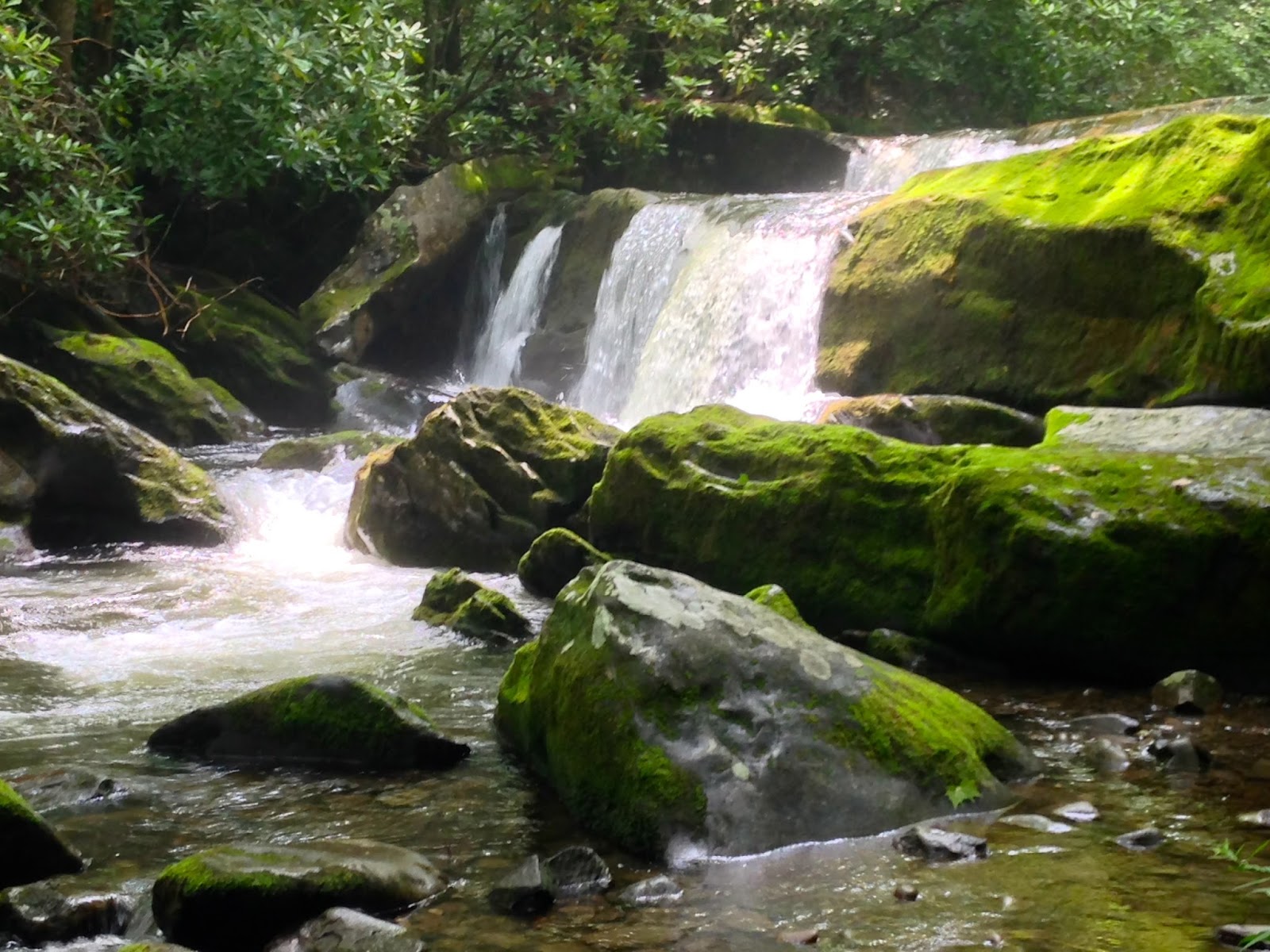
Besides the impressive waterfall listed in Mr. Malloy's newest book, there are other equally beautiful falls along this trail. We only walked up to the intersection with Panther Creek Trail, but many gorgeous cascades entertained us along the way. When you do this trail, make sure to take the time to step off the main trail on each of the little paths down to the river. You will be delighted at what you find!
There are other hidden gems along this trail, remnants from days gone by, accessed by footpaths off to the right on your way toward Panther Creek, but we chose not to venture that deep into the woods on this summer day. Also, if you go further up the trail, a tad over 4 miles from the trailhead, you will find Indian Flat Falls, another of my favorite spots. But those were not our destinations on this day. There's always more to see in this park and reasons to return time after time. And that's exactly what I plan to do--return, time after time!


