Showing posts with label waterfalls. Show all posts

Tuesday, July 7, 2015

Morning Meander up Middle Prong


Yesterday I was blessed to "take a hike" with a friend whom I met, electronically, through blogging several years ago. While my usual map-marking hiking partners were both out of town, I found myself missing my mountains after having spent the previous week in Isle of Palms and Charleston, South Carolina. I had recently discovered through Facebook that this blogging friend of mine, and I only lived a few blocks apart. Sharon has been through a terribly difficult time of personal loss, so I thought this might be the perfect time for us to take a walk in the woods together, something we both love. Although I felt like I have known her for several years by reading her blog, Gains and Losses: Life Through Sharon's Eyes, we had never met face-to-face, but what a wonderful time we had carrying on our friendship in real time!


We decided on a simple walk up Middle Prong Trail, but it turned out to be much more than that! When we crossed the large bridge spanning Lynn Camp Prong at the beginning of the trail, I wondered aloud where the side trail that branches off along Thunderhead Prong might go. Sharon said there was an old metal bridge up there, and I got probably a little too excited! I am beginning to love finding treasures that are a bit off the beaten path in my beloved Smokies. The wide, pleasant trail that I had always thought was just a fisherman's path must get a good bit of foot traffic at least until the bridge. It ambles up through the woods flanked by large rhododendron bushes and within earshot of the babbling of Thunderhead Prong.


Within probably a third of a mile from the Middle Prong trailhead, the bridge makes its appearance as the trail makes a hard right turn to cross the creek. What stands before the unsuspecting hiker is a bridge unlike anything else I have ever seen in these mountains! This single-file metal bridge has steel cables and metal posts for handrails. Although it at first reminds you of a swinging bridge, this structure is extremely sturdy as it crosses over old stone buttresses. There did appear to be one welded connection about midway across, which gave me just a second's pause, but this bridge isn't going anywhere anytime soon.


The bridge is even prettier looking back on it from the opposite side once you have crossed over it. The path continues on past the bridge, but we did not walk up it except for just a few feet. Apparently this old, unmaintained manway makes its way up around Defeat Ridge, and on up to Thunderhead Mountain. When I learned this while doing some research after returning home,  I was instantly curious about Defeat Ridge, how it got its name, and the history of this path. Hiking in this area is an off-trail adventure that may be beyond me, but there are folks who have been up there and know of the secrets that part of the park still holds. Maybe someday I will explore some of that region--it intrigues me, that's for sure!

Making our way back to the trail we had come to hike, we took time to photograph the beautiful Rosebay Rhododendron blooms which adorned our path.
Once we returned back to Middle Prong trail, we began the delightful walk along Lynn Camp Prong. I found myself watching the water, looking for the sleek shadow that might be a brook trout waiting for its next meal within view of the trail above. I have hiked this trail many times and fished it a couple of times since the park service has reopened it. This stretch of water has been home to the Brook Trout Restoration Program which required the creeks involved be closed to fishing while the rainbow trout were removed and self-sustaining brook trout populations established as they had existed before the introduction of the non-native rainbow many years ago. They may have seen me because I never did see any of them.

The agenda for this day though, was simply an easy meandering up the trail, appreciating the scenery and enjoying the company of new friends. I must say, it was relaxing to just walk up the trail, taking time to look at the massive rock walls which line the trail in some places, or stopping to appreciate the numerous cascades abundantly scattered up Lynn Camp Prong. Map marking has become an all-encompassing obsession, but this hike was enjoyable simply because we were not worried about keeping a certain pace or going great distances. The cares of the world could melt away and be forgotten in the rapids and runs, bubbles and babbles of the creek beside the trail.


In an effort to regain normalcy in her life amidst tragedy, Sharon has set a goal for herself and on this walk we would attain the first accomplishment toward that goal. She is using a book written by Johnny Malloy titled Hiking Waterfalls in East Tennessee: A Guide to the State's Best Waterfall Hikes which lists 100 of the most scenic waterfalls in our state. Some of them are in our cherished Smoky Mountains, and she checked off this first one on our hike. I was pleased to be there with her when she took this first step toward her new goal.


I do think it's a pretty cool coincidence that when I was looking for the story behind the name of Defeat Ridge I found my answer in a book also written by Johnny Malloy almost 20 years ago. According to Mr. Malloy in Trial by Trail: Backpacking in the Smoky Mountains , a vote had been taken in the 1830s to determine where a pass across the mountains would be built. Bote Mountain was chosen. Because the Cherokee Indians who were enlisted to help build the road had no "v" in their language, the name became Bote Mountain. The ridge that was defeated in that vote henceforth became known as Defeat Ridge. I just found this in an online excerpt from Mr. Malloy's book, but it is going on my reading list, that's for sure!

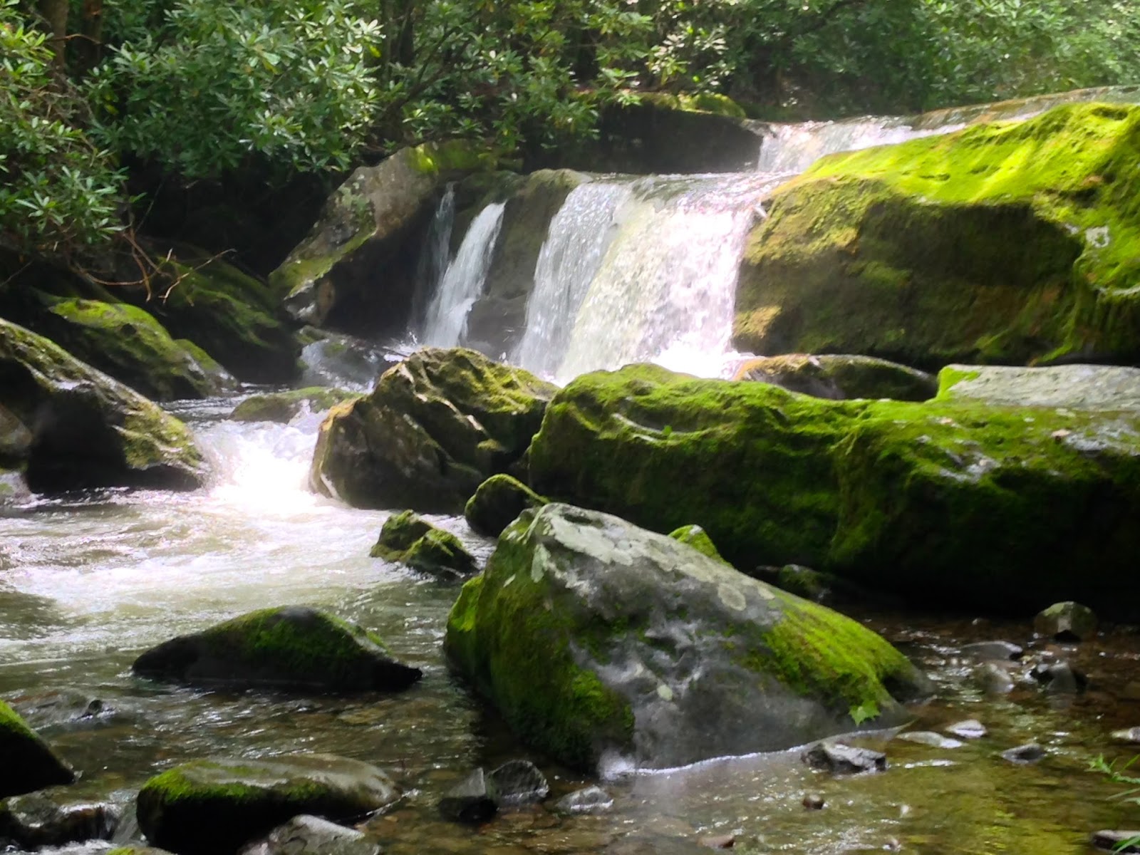

Besides the impressive waterfall listed in Mr. Malloy's newest book, there are other equally beautiful falls along this trail. We only walked up to the intersection with Panther Creek Trail, but many gorgeous cascades entertained us along the way. When you do this trail, make sure to take the time to step off the main trail on each of the little paths down to the river. You will be delighted at what you find!

There are other hidden gems along this trail, remnants from days gone by, accessed by footpaths off to the right on your way toward Panther Creek, but we chose not to venture that deep into the woods on this summer day. Also, if you go further up the trail, a tad over 4 miles from the trailhead, you will find Indian Flat Falls, another of my favorite spots. But those were not our destinations on this day. There's always more to see in this park and reasons to return time after time. And that's exactly what I plan to do--return, time after time!

Wednesday, March 13, 2013

Reward is Worth the Risk!

Temperatures on Saturday, even in Gatlinburg, were supposed to be in the low 60s--a pleasant day in early March. After checking several sources to make sure Greenbrier Road had been opened, we decided to hike to Ramsey Cascades to see the snow melt from the snows that had fallen earlier in the week. I had never hiked to Ramsey, but had heard that it was a nice but difficult trail after you got past the first mile and a half or so. We expected there to be plenty of water coming over the falls as a result if the higher temps.

The first part of the trail was a wide, pleasant uphill grade on an old roadbed running parallel to the Middle Prong of the Little Pigeon River. The rise was fairly steep, but not really very difficult. It was an absolutely gorgeous day which was warming fairly quickly, so we stopped and shed layers a time or two along the way. Any snow that had fallen during the week had melted in this area leaving behind a little mud, but our footing was sure on the wide and rocky path.

At about 1.5 miles, we came to a turn-around circle which, I supposed, marked the end of the roadbed as the now more narrow path turned off to the left. Here we began to notice the first indications that there really had been significant snow in the area in the previous days. Snow remained on the banks near the river or in heavy shade under trees, but still the path remained clear.

After about another half mile though, things began to change. Snow became more prevalent and began to cover the trail. Somewhere probably about mile two we came to the first of two split-log footbridges spanning Ramsey Prong. Even from our first view of it, we knew it would not be a fun crossing. The footbridge was covered in snow and ice, making the walk over it a little disconcerting since we still don't have crampons or microspikes for traction. However, with careful foot placement and a little luck, we made our way over that bridge without too much difficulty. At this point, we never even thought of not continuing. The snow that covered the trail was still soft enough to not be too much of an encumbrance and our desire to see the falls in the melting snow runoff was strong. We pressed on.

Once we passed that footbridge though, the snow deepened and became more icy since on this side of the river there was almost no sun making its way onto the trail. I was extremely thankful for my Leki hiking poles because they provided tremendous additional traction. About this time we were met on the trail by a couple of young guys trail running coming down from the falls. They had on trail running shoes and were moving much faster than we were, so we figured we'd be fine. They also said the falls was frozen over and extremely beautiful, which only encouraged us further to press on.
Massive tulip poplars

Soon, we came to one of my favorite parts of the trail. At about 2.6 miles there stand some of the largest trees I've seen in the Park. We passed directly between two massive tulip poplars and stopped for a photo op. You can see how large they are compared to my hiking partner standing in between them for scale. They reminded me of the other massive tulip poplar we had seen on an earlier hike on Scott Mountain, an area since devastated by a tornado-like storm that passed through last spring. I still haven't been able to determine if that ancient tree survived that storm since the trail in that area is still closed. These two stately survivors and another even larger tulip poplar just up the trail suggested that perhaps even the loggers who ravaged the park decades before had not traveled this far up the now much steeper path we were traveling. I'm glad that somehow, they were able to avoid the greed and the saws that harvested so many other such beauties that once ruled these woods.

Beyond those trees, the path conditions continued to deteriorate and we came upon the second footbridge. We had only thought the first one was a treacherous crossing. Almost nowhere on this bridge could you plate boot tread on wood or even soft snow. This is the closest we came to turning around. Using our poles to chop ice up to gain footing, we slowly, deliberately made it across and continued on towards the falls. Again we were met by other hikers who had made it up and shared that it was definitely worth continuing to see. So, on we went.

The last half mile or so, we spent holding onto roots or rocks, pulling ourselves up steep, slippery pathways which wound between and over large boulders over which, thankfully, large roots grew which provided necessary handholds to pull yourself up on and keep from sliding backwards on the ice.


Very soon, we were rewarded with a view of Ramsey Cascades unlike anything I've ever seen in my life. Water raged over the falls, but the spray from the cascades had frozen on the surrounding rocks and ground creating a sparkling fantasyland around the waterfalls. Pictures cannot begin to capture the spectacle, one that a fellow hiker who had encouraged us not to turn back had described as "an OMG moment!" As I stood there admiring the grandeur of such a sight, I knew the way home would be more treacherous than the trip up. Descending along that icy footpath would be more tricky than the climb had been, and I was right. However, we returned safely to our waiting cars with no incidents other than a couple minor slips. Would I have done anything differently, other than having some traction devices for my boots? No way! I'm so glad we didn't give up! I may never see anything so extraordinarily beautiful again in my whole life. Occasionally the reward is worth the risk, and this was just such a moment!


Saturday, February 4, 2012

The GSMNP 900?!? No promises; NEW miles!

Ok, so my little hiking group has a new goal (sort of)!  The Great Smoky Mountains National Park has 900 miles of official trails that are now calling our name.  Our hikes have taken on new direction, and new meaning.  Some of us have officially, Andrea and Kirsten, decided they want to try to hike all 900 miles over the coming years.  Because I want to do so many other things too, like Appalachian Trail hiking, bike riding, fly fishing--just to name a few, I haven't chosen to  accept that challenge at this time.
I will probably never do all 900, and that will be ok with me.  However, what I have undertaken as my challenge is to log as many new miles as possible on the hikes that I do in the Smokies now.  Currently, to the best of my ability, I have recreated my hiking adventures since moving back to Tennessee and have hiked 61.8 of the 900 miles of trails right here in my backyard.  I have hiked over a hundred total miles, but much of that was repeat mileage.  For instance, when I hiked to Grotto Falls and back, I covered 7 miles, but only 3.5 of those were new miles.  Same with Mt. Leconte--total of 10 miles, but only 5 new miles.

This past weekend our group did a loop hike that began about a couple miles down the mountain from the entrance to Cades Cove.  We hiked Finley Cane trail to Bote Mountain trail to Schoolhouse Gap trail and then traversed across Turkeypen Ridge, returning to our cars a total of 8.9 miles later.  On this day, we covered 7.8 new miles that none of us had ever hiked before.

Our hike was relaxing and not nearly as steep as climbing Chinquapin Ridge on the Walker Sisters hike a couple weeks earlier.  Our pace was quick though.  With only four hikers on this day, those who usually break out and end up waiting for the rest of us at waypoints along the hike stayed closer.  That challenged the older or less experienced members of the group to walk more briskly than usual to keep from hindering the youngsters.  I was proud of the pace I was able to sustain, but I don't feel like I get to see as much when I walk that quickly. Also, we never stopped to sit down for even a minute, so my conditioning is getting better, something that should serve me well this summer when, hopefully, we do another section of the AT.

This hike was characterized by several water crossings and since we've had a good bit of rain lately, they were challenges in the rock-hopping department.  In fact, the last one (thankfully it was the last or we'd have had wet feet all day) wasn't a rock hop at all.  It was just a wade on tiptoes and hope your boots are tall enough to keep the river out.  Mine were great! Only the top of my sock got wet on one foot, but one of our hikers had on low-cut hiking shoes and she was soaked.  That water was pretty cold too, seeing as we did the hike in January!  She was glad to get back to the car where we found her some dry socks.


One nice surprise on this hike though, due to all the rain, was an unexpected waterfall on the Turkeypen Ridge trail.  I'm not sure that it would be there at all on a day when weather had been dry for a while, so I felt privileged to stand and watch it's somewhat ethereal beauty.  It was quite pretty how it cascaded down the mountain, changing course when it hit a section of large rock outcroppings, veering off into what was almost a cave-like opening available to it as it rerouted around the boulders.

I find myself feeling very fortunate to have the camaraderie of such a wonderful group of ladies to hike with during this transition time in my life.  This is definitely helping to fill the void left by children who are growing up, moved out, and needing me less (or at least in different ways--seems like all they really need me for right now is money! And that's ok, too, for now).  I am sort of remaking myself, similar to the way they are finding their way into their futures.  I, too, feel like I'm finding new paths into mine.  And I'm liking it!