On a day when Tennessee has declared a state of emergency as a result of the ice storm, all I can do is think about hiking instead of getting out there to do a little hiking. This storm is probably going to mean I don't get to hike tomorrow either, Saturday, as I had planned to--and that's a bummer!
A hiking addiction with a full-time job and family responsibilities means there's a great deal of time spent longing to be on the trail when you can't really get out there. But I've come to find that the planning that goes into a goal like hiking all of the trails in the Smokies is half the fun.
Every Smoky Mountain hiker should have a copy of Hiking Trails of the Smokies--probably considered by most to be the Bible of those who walk the trails of the Great Smoky Mountains National Park. This book gives trail descriptions of every official trail within the park boundaries, listed alphabetically. The trail descriptions include not only interesting things to see along the path, but also historical accounts of the region and stories of those who lived here before the park was founded. There are also elevation maps which mark all significant water crossings--something quite beneficial especially if planning a winter hike when water crossings can be cold at best and dangerous at worst!
But if you are considering planning to hike all the trails of the Smokies, there's another resource you MUST have--Day Hiker's Guide to All the Trails in the Smoky Mountains by Elizabeth L. Etnier.
Liz had divided the park into regional sections and has mapped out a way to do all the trails in the park as day hikes, albeit some of them very long day hikes. This book includes directions on whether you need one vehicle or two for a hike and suggestions on where to park them. It also maps out designations of "new miles" and total mileage hiked for those of us who are tracking those statistics as a way to show progress toward the goal. However, this book would also be an excellent reference for anyone looking for day hikes that most park visitors never consider--something that is of great benefit during the highest visitation periods of the year when the most popular day hikes are often crowded, far from the secluded retreat you might be seeking. The vast majority of the trails listed in this book will not be well-traveled. In fact, on most of the hikes we do, encountering other people is a rarity.
And then there is the question of maps. I have two--The Great Smoky Mountains Trail Map on which I highlight the trails as I have completed them, a visual record of my progress and also a reminder of all that which remains to be hiked. Now that's motivation! I know hikers who have laminated this map and hung it on an office or bedroom wall, highlighting it as they go. That would be a great way to do it too, but I just keep mine folded on my desk. I highlight each new trail almost as soon as I get home and unpack my backpack.
My second map is a waterproof topographical map that makes almost every hike carefully stowed in my backpack, just in case something goes wrong. After having made a wrong turn on the AT last summer resulting in a harrowing 20-mile hike that was supposed to be a 7-miler, I have made it a point to hike with this map. I purchased it right after that hike, and it is a staple in my backpack. This map has enough detail to be of great help in case you should get confused at a trail intersection or need to know the fastest way out of the wilderness to get help.
Between all of these resources, which can be found here, I can spend hours on a cold, icy day looking forward to and mapping out the hikes I hope to do in the coming weeks and months. I can think of better ways to spend a day--hiking would be choice number one! But if it's too cold and icy to get outside, this isn't a bad way to spend an afternoon.
Friday, January 25, 2013
Wednesday, January 23, 2013
On Top of Old Smoky, All Covered with Snow
Days of continual, soaking rain had been followed by an evening of snowfall in the Smokies and the surrounding area this past week. The deluge of rain for days had me itching to get out of the house to do something active besides going to the gym. An unexpected vacation day from the snowfall would have been a great day to hike but roads were closed in many sections of the park. However, it did allow us time to plan to hike on Saturday if the roads would just open in time. Sometime on Friday afternoon the road to Cades Cove did open, and we made plans to do a short hike in that area which would allow me to do a small section of Bote Mountain Trail which I had missed and also allow Jennifer the opportunity to do Lead Cove, a trail that she had been unable to do with us the first time.
The temperature was 28 degrees as Jennifer and I got out of the truck at the Cades Cove Picnic Area. The waters of that typically quiet river that runs through the picnic area were raging with run-off from the rains. An inch or so of snow remained on the ground in many spots making this a pretty morning for a hike.
We crossed two bridges as we made our way up Anthony Creek Trail, both of which were iced over like this one making the passing difficult. The foot logs that we crossed at least three more times were even worse, but it seemed that when the footing was the most slippery, there was a supporting rail post right where we needed to place our feet to prevent us from slipping off the log. Most of the time there was a layer of crunchy snow in which our Keen hiking boots could take hold. Passages were slow, but thankfully uneventful.
It felt great to get back out here even though there were only two of us able to hike on this particular Saturday. We actually thought about not hiking with just two, but I am so very glad we did. The scenery as we gained elevation climbing up to the ridge of Bote Mountain became more and more spectacular. The snow deepened and eventually covered not only the hillsides around us, but also the trail itself. The quietude suggested that we were the only people in the world, but footprints on the path below our feet assured us that we were not the only adventure addicts who had traversed this way since the snow had fallen.
It's moments like this, as the sun's rays make the snow-covered branches glisten as if they are coated in icing made of diamond chips, when you realize how inadequate cameras are and why you must get out and see things for yourself. I knew when I took this shot that there would remain only a hint of the beauty that I actually saw--enough to remind me, but not enough to convince anyone else of its magnitude. I guess you'll have to take my word for it.
At this juncture, we left the ridge line of Bote Mountain and began the descent back down Lead Cove Trail to Laurel Creek Road. Again, I found myself not wanting to leave the mountaintops. As the snow cover diminished and the sounds of the traffic on the road and the rushing waters of Laurel Creek reached our ears, we took a moment to be thankful--thankful for our friendship, the time spent in this special place, and the good fortune to live close enough to be able to frequent it with regularity.
The temperature was 28 degrees as Jennifer and I got out of the truck at the Cades Cove Picnic Area. The waters of that typically quiet river that runs through the picnic area were raging with run-off from the rains. An inch or so of snow remained on the ground in many spots making this a pretty morning for a hike.
We crossed two bridges as we made our way up Anthony Creek Trail, both of which were iced over like this one making the passing difficult. The foot logs that we crossed at least three more times were even worse, but it seemed that when the footing was the most slippery, there was a supporting rail post right where we needed to place our feet to prevent us from slipping off the log. Most of the time there was a layer of crunchy snow in which our Keen hiking boots could take hold. Passages were slow, but thankfully uneventful.
It felt great to get back out here even though there were only two of us able to hike on this particular Saturday. We actually thought about not hiking with just two, but I am so very glad we did. The scenery as we gained elevation climbing up to the ridge of Bote Mountain became more and more spectacular. The snow deepened and eventually covered not only the hillsides around us, but also the trail itself. The quietude suggested that we were the only people in the world, but footprints on the path below our feet assured us that we were not the only adventure addicts who had traversed this way since the snow had fallen.
It's moments like this, as the sun's rays make the snow-covered branches glisten as if they are coated in icing made of diamond chips, when you realize how inadequate cameras are and why you must get out and see things for yourself. I knew when I took this shot that there would remain only a hint of the beauty that I actually saw--enough to remind me, but not enough to convince anyone else of its magnitude. I guess you'll have to take my word for it.
Not surprisingly, the closer we got to the top of Bote Mountain, the more snow crunched under our feet. Up here, you could definitely see evidence of many other hikers who had come out to experience the mountains under the cover of snow. We chose our footing carefully on this section, paying so much attention to our steps that we totally missed campsite #9 which lies not far off this section of the trail. The only way we knew about it at all was because only a minute or two after we came to the intersection with Bote Mountain Trail we had company. Suddenly up the trail behind us came a group of men who had spent the night at campsite #9 and had seen us walk by on the trail. But we had not seen or heard them. They were headed to Rocky Top to witness the views of the mountains in the snow from that high vantage point, so we parted, going opposite directions on Bote Mountain Trail.
We had intended to rest for a while at the top (that's a pretty steep climb we had just made in the snow), but after lingering for only a few minutes, the chill began to creep in encouraging us to keep moving. I had not been cold on the hike with the exception of the first 1/4 mile or so when I had zipped my jacket up enough to cover my face. But here on the mountaintop the air was crisp and cold. As we moved along Bote Mountain Trail toward Lead Cove, we were afforded beautiful views of the valleys below shrouded in cloud cover. This short stretch of Bote Mountain Trail that was new to me (1.2 miles) was much more pleasant than the other parts of the trail that I had covered. There were fewer rocks to trip up an unsuspecting hiker and nice views on either side to enjoy as you walked.
Tuesday, January 22, 2013
Change in Perspective
Typical hikers flock to the Smoky Mountains for those destination hikes like Laurel Falls, Abrams Falls, Mt. LeConte, or Charlie's Bunion where breathtaking vistas or cascades are the reward for walking over rocks and roots for several miles. Hiking in the fog is a sure way to shift one's perspective--if you cannot look out as you walk along a ridge line at the peaks and valleys that surround you but that you cannot see, you find yourself noticing things you otherwise would have missed. On January 12, that is exactly what we encountered as we chose to hike Thomas Divide Trail, which I'm sure is aptly named as it divides two separate water basins, to Newtons Bald Trail down to the Smokemont area.
Instead of views of the mountains that undoubtedly we would have been able to see on a clear day, we were mesmerized by the Lothlorein-like (from Tolkein's mythology of elves) appearance of the trees covered in lichen and moss which were truly shimmering in the mists of the morning. The mythological feeling was so strong, I would not have been surprised to see Lady Galadriel watching us from the distance. Sadly, and perhaps by Lady Galadriel's design, we were unable to capture the magic of this place on film. The photos we took show only pale green lichen clinging to damp trees--the vibrancy of their color and the magic with which they transformed this place slipped out of the frame to be only captured in our memories.
The highlights of this hike were those small things--a squirrel's picnic table, where he had stopped to open and enjoy the contents of several acorns on this frosty morning,or a lacy leaf partly consumed by decay, but stunningly beautiful even in that condition as it held tiny water droplets between the remains of the leaf veins.
These things of beauty were sights we would surely have missed on a clear day. We would have been so enamored with the views in the distance that we would have overlooked the treasures that were right at our feet. Somehow this strikes me as true about life in many ways. Often times we are so caught up in our larger goals or desires that we simply miss the treasures that are right in our grasp every moment--the delight that we can find in a daughter's hug, in holding a husband's hand, or the rare but strong embrace of a son. Sometimes a change in perspective is exactly what we need.
| Lichen covered trees glowed an elvish green |
| Closeup of some of the lichen |
The highlights of this hike were those small things--a squirrel's picnic table, where he had stopped to open and enjoy the contents of several acorns on this frosty morning,or a lacy leaf partly consumed by decay, but stunningly beautiful even in that condition as it held tiny water droplets between the remains of the leaf veins.
These things of beauty were sights we would surely have missed on a clear day. We would have been so enamored with the views in the distance that we would have overlooked the treasures that were right at our feet. Somehow this strikes me as true about life in many ways. Often times we are so caught up in our larger goals or desires that we simply miss the treasures that are right in our grasp every moment--the delight that we can find in a daughter's hug, in holding a husband's hand, or the rare but strong embrace of a son. Sometimes a change in perspective is exactly what we need.
Monday, January 21, 2013
Whatever the Weather, We Hike Together!
On January 2nd, my little group decided to venture the furthest away that we've been on one of our hikes--something that is going to have to be a more regular thing now that we've done such a large percentage of the Smokies hikes closer to home. This particular hike was my idea because I really wanted to spend a couple of days with my parents in Hickory, NC and this trailhead was right on my way. I think it was a year ago that I took a picture of the AT steps that go up the other way toward Hot Springs here where I-40 crosses the Appalachian Trail and said that they were really calling my name. I guess that was a premonition of the intensity of this calling that hiking would place on me in 2012. It has become an addiction, something that makes Saturdays almost unbearable when weather or other circumstances make it impossible to hike.
On this day, the weather was iffy to say the least. That is not what the forecast had said, but we've come to know that weather forecasts in the mountains are far from reliable. Instead of clear skies when we arrived at the trailhead, we found ourselves surrounded by clouds, not above our heads, but literally all around us. The heavy fog felt like rain, but I kept assuring my hiking partners that is was just cloud moisture, (yeah right!) Thankfully we all keep lightweight rain jackets in our packs for just such moments, so we donned them and stepped out onto the Appalachian Trail. For those interested in hiking this trail, we parked one car at the Big Creek Ranger Station and one car in the pullout across from the trailhead to the AT on TN Highway 32 (which, be warned, is really a dirt road--I couldn't believe it, but it was!) I was driving my Mustang convertible so I was a tad nervous about that, but the road is well maintained and my little pony did just fine.
We had not been hiking long when, with the change in elevation, the temperatures began to drop enough to turn the misty "cloud moisture" to snow. Suddenly, our moods, previously somewhat dampened by the rain, began to lighten as the air was transformed by the crystals of snow shimmering in the early morning light. Everything around us became covered in a dusting of snow as we climbed higher up the AT toward Mt. Cammerer.
We stopped short of Cammerer on this day, turning around at the intersection with Lower Mt. Cammerer Trail which we had come up a month or so earlier. It was at this intersection where hiker brain turned Davenport Gap (on the trail sign) to Gavenport Dap. It remains Gavenport Dap in the minds of our group members simply because we laughed so hard about it that day.
Turning around, we made our way back to the trail head of Chestnut Branch Trail and began a not too difficult descent back toward our waiting car. The guide books had me a little worried about the steepness of this trail, but it is fine--nothing to worry about at all. It was a very pleasant trail which came in contact several times (but not with large water crossings) with what I assumed was Chestnut Branch for a truly delightful hike back down.
I had read that we would see large chestnut trees still lying on the forest floor. But I wasn't prepared for the size of these trees nor the good condition in which the old logs were still preserved. My dad, who remembers the chestnuts when they were kings of the forest, said that the moss that grows on them help preserve them from dry rot. The moisture of these woods near the river provide the perfect conditions for them to be preserved long after they were felled by the Chestnut Blight.
As our hike drew to an end, I found myself with a strong urge to turn around and go back up. I have begun to notice that, especially on a hike like this of only about 6 miles, I'm not ready to return to civilization. Subconsciously, I slow my pace on that last half mile or so, delaying the inevitable. I love my family and my job, so it's not that I don't want to go back to them, but that respite that I find in these mountains, that powerful sense of renewal that fills me, is so intense that I simply do not want to leave it. It is this overwhelming feeling that has become like bread and water to me--this that brings me back as often as my schedule allows--the driving force behind why I hike.
Tuesday, January 1, 2013
Accomplished Goals and Great Friends
I did it! My goal for hiking this year was to reach 200 new miles hiked in the Great Smoky Mountains National Park, and I surpassed that mark on New Year's Eve in the company of my hiking buddies, the Bucket Brigade. We traversed up Bradley Fork Trail to Cabin Flats Trail and on to Backcountry Campsite #49 for the express purpose of finishing my 200. We had done part of Bradley Fork earlier in the month, but snows in the higher elevations kept us from doing the hike we had planned for this day. We decided that a steep descent down Newton's Bald from Thomas Divide probably wasn't a good idea in 5-6 inches of snow. So we chose to do this lower hike instead. Bradley Fork is one of my favorite trails so far because it runs alongside a river for about 4 miles before veering off and moving up toward Hughes Ridge. It was at that junction that we went straight on Cabin Flats Trail, continuing along the river up to Campsite 49. The river rushed with considerable force after all the rains we've had over the last week--rains (and actually snows at Newfound Gap) that threatened to keep me from my goal.
Campsite #49 was a beautiful campsite indeed, flanked on one side by the gorgeous Bradley Fork Creek providing ample swift running water and on the other by a ridge rising high up above. The flats between the two makes for several great tent sites, and I saw two fire circles both with some seating available for hikers. There was even a "recliner" available--a tree trunk bending in the perfect curvature to emulate a fully reclined Lazy Boy. It was snow covered so I didn't try it, but I bet it would be comfy after a long day's hike.
Just before reaching the campsite, we came across a rusted old trestle bridge on which we crossed Bradley Fork Creek. This structure insisted that you stop and wonder about its past. I don't know if it was once a rail crossing used to harvest the timber from the area or what, but I've never seen anything like it in these mountains before. It looked old and I'd love to know its history. We spent a bit of time there taking pictures and enjoying the beauty of the bridge and the gorgeous afternoon.
In truth, I've done two hikes during the week after Christmas in order to reach my goal. I had the pleasure of taking my stepson, Phillip, who lives in sunny Florida on a hike on Thursday. On that day our choice of hikes took us to the back of Cade's Cove to do the first half of Cooper Road Trail. I had wanted to do a destination hike like Charlie's Bunion with him, but we were a little afraid of the higher elevations and after the snows the night before, we didn't think Newfound Gap Road would be open. We were also on a tight timetable due to other obligations that evening, so we chose one of the few close hikes we had left. We were not prepared for what we saw.
Utter devastation prevailed as we moved along Cooper Road, literally an old roadbed, away from the Cove and further toward the intersection with Hatcher Mountain and Beard Cane trails. We crawled over or under more trees than I could begin to count that were downed across our path. The tornado that hit this area a year or so ago and the storm that came through this spring, killing at least two park visitors, had destroyed innumerable trees in this region. It eerily felt as if you were moving through a war zone. Phillip summed it up pretty well when he said it looked like someone came along with a lawnmower and sheered off the tops of the trees along the ridges. The tops of those trees and whole other ones uprooted or broken off were scattered everywhere, piled askew like someone spilled a box of toothpicks. It's something you would have to see to believe.
As I hiked my way out of 2012, I contemplated how lucky I have been to fine a group of women who love to hike these mountains along with me. Having set our sights on the loftier goal of hiking all of the trails in the Smokies, we have worked our way into a full-fledged addiction. We find ourselves drawn to the woods on almost any day that we aren't working and the weather is cooperative. The camaraderie is a blessing and the serenity of the mountains has become our source of sanity in an insane world. So, Happy New Year, and here's to lots of "new miles" in 2013!
Campsite #49 was a beautiful campsite indeed, flanked on one side by the gorgeous Bradley Fork Creek providing ample swift running water and on the other by a ridge rising high up above. The flats between the two makes for several great tent sites, and I saw two fire circles both with some seating available for hikers. There was even a "recliner" available--a tree trunk bending in the perfect curvature to emulate a fully reclined Lazy Boy. It was snow covered so I didn't try it, but I bet it would be comfy after a long day's hike.
Just before reaching the campsite, we came across a rusted old trestle bridge on which we crossed Bradley Fork Creek. This structure insisted that you stop and wonder about its past. I don't know if it was once a rail crossing used to harvest the timber from the area or what, but I've never seen anything like it in these mountains before. It looked old and I'd love to know its history. We spent a bit of time there taking pictures and enjoying the beauty of the bridge and the gorgeous afternoon.
In truth, I've done two hikes during the week after Christmas in order to reach my goal. I had the pleasure of taking my stepson, Phillip, who lives in sunny Florida on a hike on Thursday. On that day our choice of hikes took us to the back of Cade's Cove to do the first half of Cooper Road Trail. I had wanted to do a destination hike like Charlie's Bunion with him, but we were a little afraid of the higher elevations and after the snows the night before, we didn't think Newfound Gap Road would be open. We were also on a tight timetable due to other obligations that evening, so we chose one of the few close hikes we had left. We were not prepared for what we saw.
Utter devastation prevailed as we moved along Cooper Road, literally an old roadbed, away from the Cove and further toward the intersection with Hatcher Mountain and Beard Cane trails. We crawled over or under more trees than I could begin to count that were downed across our path. The tornado that hit this area a year or so ago and the storm that came through this spring, killing at least two park visitors, had destroyed innumerable trees in this region. It eerily felt as if you were moving through a war zone. Phillip summed it up pretty well when he said it looked like someone came along with a lawnmower and sheered off the tops of the trees along the ridges. The tops of those trees and whole other ones uprooted or broken off were scattered everywhere, piled askew like someone spilled a box of toothpicks. It's something you would have to see to believe.
As I hiked my way out of 2012, I contemplated how lucky I have been to fine a group of women who love to hike these mountains along with me. Having set our sights on the loftier goal of hiking all of the trails in the Smokies, we have worked our way into a full-fledged addiction. We find ourselves drawn to the woods on almost any day that we aren't working and the weather is cooperative. The camaraderie is a blessing and the serenity of the mountains has become our source of sanity in an insane world. So, Happy New Year, and here's to lots of "new miles" in 2013!
Sunday, December 2, 2012
Bradley Fork and Smokemont Trail--So much better than Xanax!
Whew! After a horrible week at work, by the time Friday afternoon rolled around, I was physically and mentally exhausted--so much so that I almost cancelled our standing Saturday morning hike. I did call my friends and told them I just didn't think I had a long hike in me; I was just too tired. Thankfully, my hiking buddies were willing to do something totally new and shorter, so we found ourselves travelling all the way up and over Newfound Gap Road into the North Carolina side of the Smokies. As we approached the highest section of Newfound Gap Road, there was what we first thought was heavy frost on the road and the grass alongside of the road. However, after we crossed over the top and began the ride down the NC side, it was clear that it was definitely snow on the road. We even commented that one thing we have to think about when we planned these NC hikes was to make sure the weather was clear enough that the road wouldn't close behind us as a result of unexpected snow.
When we arrived at Smokemont Campground, we looked for the D loop where the hiker parking was supposed to be. The gate to the back loops of the campground was locked, so we had to park closer to the front instead. Only one of the restrooms was open--the one closest to the front of the campground, but that was way better than having to drive several miles out to a store as we have done on previous hikes.
We were shocked at how much colder it was on this side of the ridgeline than it had been at home. I hadn't even packed gloves since it was supposed to be over 60 degrees at home, but that was a mistake. Luckily I did have an extra pair of socks and I keep a pair of Hot Hands in my backpack in the winter, so on they went! This made for a little loss of dexterity, but it worked out fine. Once I deduced that my thumb needed to go in the heel of the sock, I was good to go. I even figured out how to use my camera with the socks on my hands!
We took the advice of the author of the Hiking Trails of the Smokies and started our 5.6 mile loop on the Bradley Fork Trail which runs along one of the most picturesque rivers in the Park. I kept scanning the runs and deep holes for any sign of Brookies, but without my polarized sunglasses, I couldn't spot them even though I know they must have been there. Bradley Fork Trail is a slow ascent on a road bed, part of which is a section of the Benton MacKaye Trail, a 300 mile trail named for one of the men who first envisioned the Appalachian Trail. The Benton MacKaye runs from Big Creek (in the Smokies--not too far from where we were) to Springer Mountain, Georgia, sharing the Southern Terminus with the AT. The short section that we were on was very pleasant, with a gradual grade and the musical rippling of the waters of the Bradley Fork of the Oconaluftee River here at Smokemont. The entire length of the Bradley Fork Trail that we were on until it reached the Smokemont Trail was one of the most beautiful trails we have ever done. We resolved that we would return and bring some of our group members that don't like to do the longer hikes but enjoy a nice, peaceful day in the Park. It is definitely worth the drive.
After about 1.7 miles on the Bradley Fork Trail, we came to the intersection of the Smokemont Loop Trail. Just as the Loop trail headed off to the left, it went down a hill on beautifully constructed steps to one of the longest footlogs in the Smokies. This footlog is narrow and long, but plenty sturdy and you simply must stop in the middle to enjoy the view of this beautiful stream. Once the trail crosses the river, it becomes a single-file trail strewn with leaves and climbing up and around the hills. This steady climb goes on for about 1.75 miles and requires several stops to keep your heart from beating in your ears, but it is a pleasant climb. The trail is well-maintained, showing none of the erosion that other similar trails we've traversed recently have shown. Much of the trail is surrounded by gorgeous rhododendron thickets and tunnels or clearings that overlook nearby peaks .
After topping out at not quite two miles in, the downhill began, not quite as steep as the ascent, but a little longer, hence the recommendation in the Hiking Trail book to do the Bradley Fork Trail first.
Fairly close to the end of this loop, we encountered a large tree which had fallen over the trail. The youngest member of our party, almost 20 years younger than me, went under the large trunk which blocked our path. Jennifer and I decided we would climb over it. This proved to be a comical moment when she got stuck astride this huge log, unable to move in either direction with feet way off the ground. We laughed till we cried and then helped her make it over.
Shortly after that we were still talking and enjoying our day, reluctant to come to the end of this delightful hike, when we rounded a bend in the trail. Thump! GRrrrr! and a flash of black running up the slope at a remarkable speed--so fast our eyes could hardly focus on it. I suppose we scared that bear as much as he scared us, but we quickly pulled our bear mace out and removed the orange safety devices from the trigger. After a few minutes of waiting and talking loudly to our friend the bear, we moved on down the trail, ever on the alert in case it doubled back down to the trail. We never saw him again, but I must say, although I knew bears could run at 30 miles per hour, I had not realized just how fast that really was running almost straight up the slope of that mountain. Not long after we got our heart rates back to normal we came to a beautiful bridge built in 1921, marking the end of this perfectly wonderful hike.
This 5.6 mile loop hike was just exactly what I needed to help deal with all the stressors from work during this hectic week. Who needs Xanax when you've got the most beautiful place in the world right up the road? Now, if I could only figure out how to hike, oh, somewhere around Wednesday, I think it would make the work week much more bearable!
When we arrived at Smokemont Campground, we looked for the D loop where the hiker parking was supposed to be. The gate to the back loops of the campground was locked, so we had to park closer to the front instead. Only one of the restrooms was open--the one closest to the front of the campground, but that was way better than having to drive several miles out to a store as we have done on previous hikes.
![]() |
| Socks make pretty good gloves in a pinch |
We took the advice of the author of the Hiking Trails of the Smokies and started our 5.6 mile loop on the Bradley Fork Trail which runs along one of the most picturesque rivers in the Park. I kept scanning the runs and deep holes for any sign of Brookies, but without my polarized sunglasses, I couldn't spot them even though I know they must have been there. Bradley Fork Trail is a slow ascent on a road bed, part of which is a section of the Benton MacKaye Trail, a 300 mile trail named for one of the men who first envisioned the Appalachian Trail. The Benton MacKaye runs from Big Creek (in the Smokies--not too far from where we were) to Springer Mountain, Georgia, sharing the Southern Terminus with the AT. The short section that we were on was very pleasant, with a gradual grade and the musical rippling of the waters of the Bradley Fork of the Oconaluftee River here at Smokemont. The entire length of the Bradley Fork Trail that we were on until it reached the Smokemont Trail was one of the most beautiful trails we have ever done. We resolved that we would return and bring some of our group members that don't like to do the longer hikes but enjoy a nice, peaceful day in the Park. It is definitely worth the drive.
After about 1.7 miles on the Bradley Fork Trail, we came to the intersection of the Smokemont Loop Trail. Just as the Loop trail headed off to the left, it went down a hill on beautifully constructed steps to one of the longest footlogs in the Smokies. This footlog is narrow and long, but plenty sturdy and you simply must stop in the middle to enjoy the view of this beautiful stream. Once the trail crosses the river, it becomes a single-file trail strewn with leaves and climbing up and around the hills. This steady climb goes on for about 1.75 miles and requires several stops to keep your heart from beating in your ears, but it is a pleasant climb. The trail is well-maintained, showing none of the erosion that other similar trails we've traversed recently have shown. Much of the trail is surrounded by gorgeous rhododendron thickets and tunnels or clearings that overlook nearby peaks .
After topping out at not quite two miles in, the downhill began, not quite as steep as the ascent, but a little longer, hence the recommendation in the Hiking Trail book to do the Bradley Fork Trail first.
| Typical section of the Smokemont Loop Trail |
Fairly close to the end of this loop, we encountered a large tree which had fallen over the trail. The youngest member of our party, almost 20 years younger than me, went under the large trunk which blocked our path. Jennifer and I decided we would climb over it. This proved to be a comical moment when she got stuck astride this huge log, unable to move in either direction with feet way off the ground. We laughed till we cried and then helped her make it over.
| The ridge where the bear had been |
This 5.6 mile loop hike was just exactly what I needed to help deal with all the stressors from work during this hectic week. Who needs Xanax when you've got the most beautiful place in the world right up the road? Now, if I could only figure out how to hike, oh, somewhere around Wednesday, I think it would make the work week much more bearable!
Sunday, November 25, 2012
Frosty Morning on Meigs Mountain
The temperature reading on the dash of my vehicle showed 26 degrees as we made our way to Tremont Institute to drop a car to be waiting for us when we finished the hike chosen for today. The temperature had not changed when we pulled into the parking lot at Elkmont for the Jake's Creek Trailhead. We bundled up--layers of Cuddleduds, hiking pants, a short-sleeved UnderArmour, a long-sleeved North Face warm gear shirt, and then to top that all off, a fleece pull-over. Of course, gloves and a hat were the final accoutrements for the day. We were determined to stay warm, that's for sure!
We only had to travel about .8 miles on Jake's Creek Trail, but that outer layer of fleece pullover didn't even last to the juncture with Meigs Mountain Trail. I shed it about half way up! It spent the rest of the day tied around my waist. Jake's Creek Trail is wide and nice, but it gains elevation pretty fast. Bundled up in all that gear, that short stint on Jake's Creek was the hardest part of our day. By the time I reached Meigs Mountain Trail, I had shed the jacket, the hat, and the gloves. The gloves would come back on, but the hat and jacket were simply along for the ride. Layering for a winter hike is not something I'm good at yet. I feel like I need to have enough clothing with me to survive a night out in case of trouble, but that makes for a heavy pack.

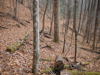
Meigs Mountain Trail is a pleasant trail which meanders along overlooking gaps and rises which you can see and enjoy but don't have to climb. This trail is nice and flat (compared to most trails in the Smokies anyway). The larger trees found on some other trails are missing here because this area was logged extensively in the early 1900s. But that does not detract from the beauty of this area, in fact, it may enhance in some ways the views that you have down into these deep gaps.
At about 1.9 miles in on Meigs Mountain Trail, we came to backcountry campsite #20, a large and beautiful area which would hold a great many tents. There's a clear, tumbling water source, unlike the campsite we came to later in our hike. There is also an old wagon wheel laying on the ground and another piece of metal or two from some former day. We discussed the idea of coming back here to camp one night to practice what it will be like as we prepare for our AT section hike in the summer. This is a lovely campsite and not very difficult to access.
Hiking on, we eventually came to the juncture where Curry Mountain Trail comes into Meigs Mountain Trail. There was a tree down that had broken about 2 feet off the ground but had not totally come apart, so the trunk of the tree made a perfect place to sit to rest and eat lunch.
After lunch we continued on and a quick two mile walk past our lunch site led us to the intersection with Meigs Creek Trail. At this point, Meigs Mountain Trail's name changes to Lumber Ridge and the terrain and trail conditions changed significantly soon after. I was under the false impression that Lumber Ridge was a steady descent back to Tremont Institute, but I had apparently not looked closely enough at the trail books before I left. Lumber Ridge makes a steady, but not too difficult, climb up to the saddle at the crest of Lumber Ridge. After that, the trail does descend into the valley below. It is here, on this downhill portion of Lumber Ridge Trail that we were the most worried today. There had apparently been a little rain the previous day or night and in these temperatures, especially when the ridge we were on was shielded from the sun, there were resulting small droplets which had turned to ice. These were scattered all over the leaves that covered the path below our feet. The leaves themselves were covering up the roots and occasional rocks that would trip the unwary hiker, but the little droplets of ice made it very slick. We descended slowly, being careful to watch our footing along the way. Lumber Ridge Trail is narrow in sections and undergoing some erosion on the downslope side leaving areas where one misstep could send one sliding down a very long and steep hillside. However, this trail does offer some excellent views of the surrounding mountains and valleys.
As we approached the lower regions of the Lumber Ridge Trail, about the time we began to hear the Middle Prong River below us, we came to an area of rock outcroppings which, according to Hiking Trails of the Smokies (the Smoky Mountain hiker's Bible) is a rock called Metcalf Phyllite, a metamorphosed shale. It provided something cool to look at other than your feet carefully picking a safe place to land.
We only had to travel about .8 miles on Jake's Creek Trail, but that outer layer of fleece pullover didn't even last to the juncture with Meigs Mountain Trail. I shed it about half way up! It spent the rest of the day tied around my waist. Jake's Creek Trail is wide and nice, but it gains elevation pretty fast. Bundled up in all that gear, that short stint on Jake's Creek was the hardest part of our day. By the time I reached Meigs Mountain Trail, I had shed the jacket, the hat, and the gloves. The gloves would come back on, but the hat and jacket were simply along for the ride. Layering for a winter hike is not something I'm good at yet. I feel like I need to have enough clothing with me to survive a night out in case of trouble, but that makes for a heavy pack.
The most interesting things along this part of the trail are the old vacation homes common in this Elkmont area. Apparently these home owners escaped being removed from the Park until 1992 when their extended leases expired along with that of the stately old Wonderland Hotel. The end of that era left remnants of what would have once been quaint, relaxing places for their owners to retreat from the hustle and bustle of the real world below. This old home with the family name of Croftton on the front sports a lovely stone fireplace still in excellent shape, but the walls and ceiling are crumbling after 20 plus years of disuse by anything other than Park wildlife. We did not go in these old homes--they are condemned and off limits--but this picture was taken through a window whose glass panes had long ago been broken out.
We returned to the trail and continued the ascent which soon led us to the trailhead for Meigs Mountain Trail which turns to the right and then crosses over Jake's Creek fairly soon. We at first thought we would have to cross Jake's Creek by rock hopping, but soon found a footbridge hiding just a short distance downstream. There was one place just above the Jake's Creek Crossing where you come to a fork in the trail. There is a sign for Meigs Mountain Trail, but it is placed at an angle that is really not very helpful. We stood for a minute at this crossing debating which way to go. We decided the trail that went down by the river probably wasn't the main trail, so we forked to the left here. Thankfully we were correct in our decision.Meigs Mountain Trail is a pleasant trail which meanders along overlooking gaps and rises which you can see and enjoy but don't have to climb. This trail is nice and flat (compared to most trails in the Smokies anyway). The larger trees found on some other trails are missing here because this area was logged extensively in the early 1900s. But that does not detract from the beauty of this area, in fact, it may enhance in some ways the views that you have down into these deep gaps.
| Backcountry Campsite #20 Great Smoky Mountains National Park |
| The water source for Backcountry Campsite #20 |
Hiking on, we eventually came to the juncture where Curry Mountain Trail comes into Meigs Mountain Trail. There was a tree down that had broken about 2 feet off the ground but had not totally come apart, so the trunk of the tree made a perfect place to sit to rest and eat lunch.
After lunch we continued on and a quick two mile walk past our lunch site led us to the intersection with Meigs Creek Trail. At this point, Meigs Mountain Trail's name changes to Lumber Ridge and the terrain and trail conditions changed significantly soon after. I was under the false impression that Lumber Ridge was a steady descent back to Tremont Institute, but I had apparently not looked closely enough at the trail books before I left. Lumber Ridge makes a steady, but not too difficult, climb up to the saddle at the crest of Lumber Ridge. After that, the trail does descend into the valley below. It is here, on this downhill portion of Lumber Ridge Trail that we were the most worried today. There had apparently been a little rain the previous day or night and in these temperatures, especially when the ridge we were on was shielded from the sun, there were resulting small droplets which had turned to ice. These were scattered all over the leaves that covered the path below our feet. The leaves themselves were covering up the roots and occasional rocks that would trip the unwary hiker, but the little droplets of ice made it very slick. We descended slowly, being careful to watch our footing along the way. Lumber Ridge Trail is narrow in sections and undergoing some erosion on the downslope side leaving areas where one misstep could send one sliding down a very long and steep hillside. However, this trail does offer some excellent views of the surrounding mountains and valleys.
Beautiful view from one of the openings in the trees along Lumber Ridge Trail
Subscribe to:
Posts (Atom)


